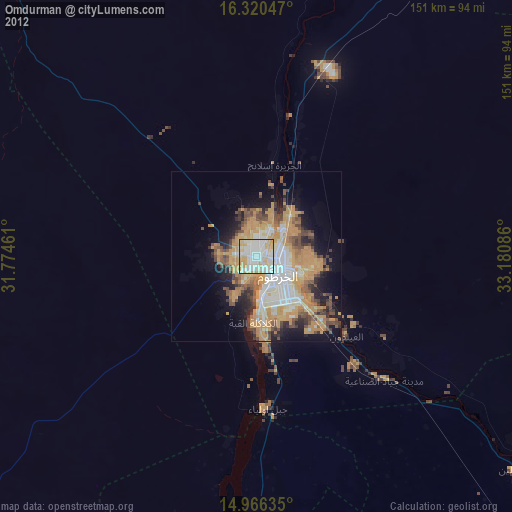
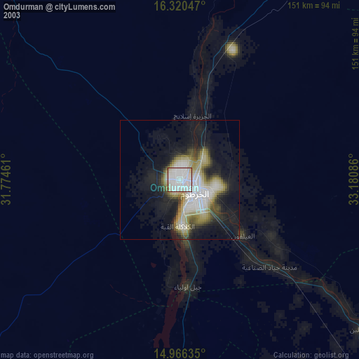
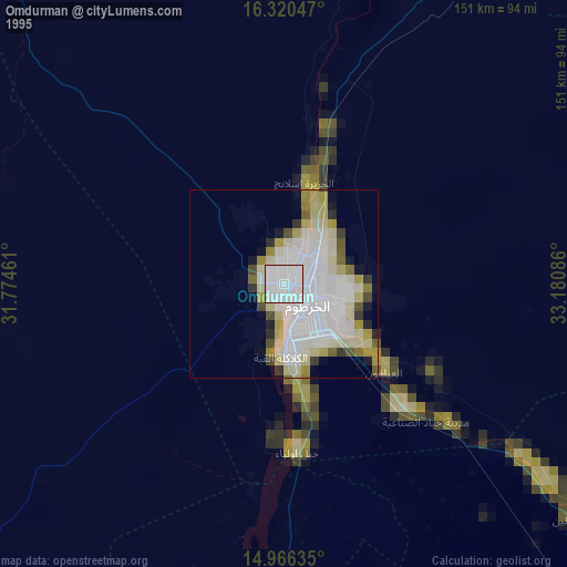
Omdurman night lights from space
Night Light of Omdurman (Khartoum) from space (Sudan) Src. Average luminocity for 10x10km area is 97.2078% and for 50x50km: 36.6932%.
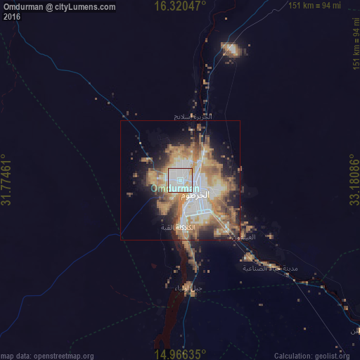
Analysis of Omdurman night lights 2016
Square area 10x10 km:
 49.78%
90-99
41.56%80-89
8.01%70-79
0.65%60-69
0%50-59
0%40-49
0%30-39
0%20-29
0%10-19
0%0-9
0%Square area 50x50 km:
7.99%90-99
7.07%80-89
4.1%70-79
5.64%60-69
8.2%50-59
4.91%40-49
4.65%30-39
3.14%20-29
5.49%10-19
8.77%0-9
40.04%Clear (daylight) street map image can be seen on geolist.org.
Map coordinates:
16° 19' 13.7" North, 31° 46' 28.6" East
15° 38' 40.3" North, 32° 28' 39.8" East
14° 57' 58.9" North, 33° 10' 51.1" East
Some cities around Omdurman sort by population:
• Khartoum
11.9 km =7.4 mi,  150°
150°
• Al Hasaheisa
132.6 km =82.4 mi,  138°
138°
• Al Qiţena
87.5 km =54.4 mi,  187°
187°
• Al Hilāliyya
112.8 km =70.1 mi,  134°
134°
• El Matama
151.1 km =93.9 mi,  38°
38°
• Wad Rāwah
89.1 km =55.4 mi, 127°
• Al Masallamiyya
150.5 km =93.5 mi, 142°
• Wad az Zāki
134.7 km =83.7 mi, 192°
365137 (p: 1,200,000)
Sources (retrieved 2019-11-25):
» NASA, Earths city lights 1995
» NASA city lights 2003
» Earth at Night: Flat Maps 2012, 2016