Khartoum night lights from space
Night Light of Khartoum from space (Sudan) Src. Average luminocity for 10x10km area is 96.6061% and for 50x50km: 38.0616%.
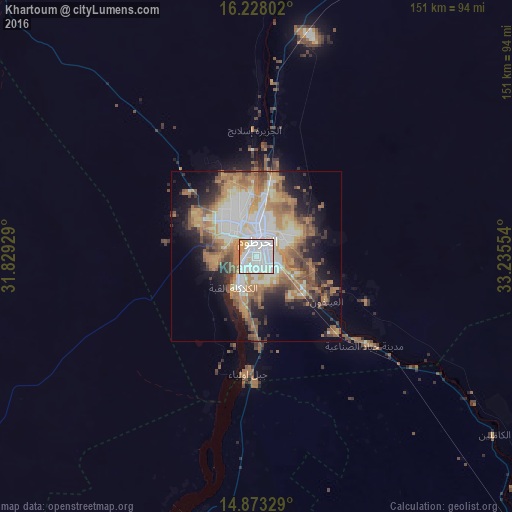
Analysis of Khartoum night lights 2016
Square area 10x10 km:
 56.49%
90-99
32.03%80-89
3.46%70-79
7.79%60-69
0.22%50-59
0%40-49
0%30-39
0%20-29
0%10-19
0%0-9
0%Square area 50x50 km:
7.99%90-99
7.07%80-89
4.14%70-79
5.97%60-69
8.54%50-59
5.4%40-49
4.76%30-39
3.4%20-29
5.54%10-19
10.09%0-9
37.09%Clear (daylight) street map image can be seen on geolist.org.
Map coordinates:
16° 13' 40.9" North, 31° 49' 45.4" East
15° 33' 6.4" North, 32° 31' 56.7" East
14° 52' 23.8" North, 33° 14' 7.9" East
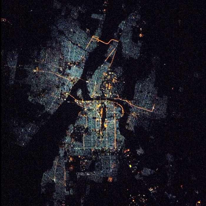
Fantastic image of Khartoum from space taken by astronauts [src2], but I don't have information about it's orientation, scale or angle. If necessary, it was rotated manually, so North points approximately to upper direction. Click to zoom in:
Some cities around Khartoum sort by population:
• Omdurman
11.9 km =7.4 mi,  330°
330°
• Al Hasaheisa
121 km =75.2 mi,  137°
137°
• Al Qiţena
78.4 km =48.7 mi,  193°
193°
• Al Hilāliyya
101.5 km =63.1 mi,  132°
132°
• Wad Rāwah
78.3 km =48.7 mi,  123°
123°
• Al Kiremit al ‘Arakiyyīn
141 km =87.6 mi,  161°
161°
• Al Masallamiyya
138.8 km =86.2 mi, 141°
• Wad az Zāki
126.1 km =78.4 mi,  196°
196°
379252 (p: 1,974,647)
Sources (retrieved 2019-11-25):
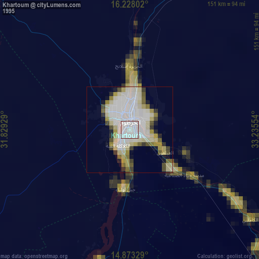
» NASA, Earths city lights 1995
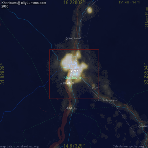
» NASA city lights 2003
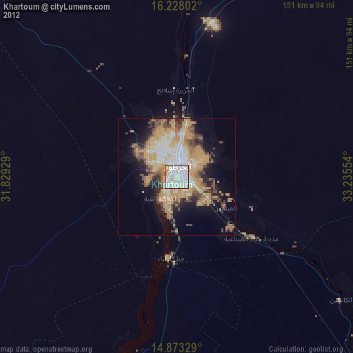
» Earth at Night: Flat Maps 2012, 2016
Src.2: NASA.gov