El Fula night lights from space
Night Light of El Fula (West Kordofan State) from space (Sudan) Src. Average luminocity for 10x10km area is 2.9855% and for 50x50km: 2.2149%.
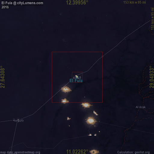
Analysis of El Fula night lights 2016
Square area 10x10 km:
 0%
0%90-99
0%80-89
0%70-79
0.83%60-69
0.83%50-59
1.45%40-49
1.03%30-39
0.83%20-29
0%10-19
0%0-9
95.04%Square area 50x50 km:
0.15%90-99
0.2%80-89
0.17%70-79
0.15%60-69
0.27%50-59
0.6%40-49
0.53%30-39
0.49%20-29
0.33%10-19
1.46%0-9
95.65%Clear (daylight) street map image can be seen on geolist.org.
Map coordinates:
12° 23' 58.4" North, 27° 38' 35.1" East
11° 42' 43" North, 28° 20' 46.3" East
11° 1' 21.4" North, 29° 2' 57.6" East
Some cities around El Fula sort by population:
• El Daein
243.4 km =151.2 mi,  263°
263°
• An Nuhūd
110.3 km =68.5 mi,  4°
4°
• Kadugli
168.7 km =104.8 mi,  117°
117°
• Dilling
146.8 km =91.2 mi,  75°
75°
• Al Mijlad
100.8 km =62.6 mi,  221°
221°
• Abū Zabad
121.2 km =75.3 mi,  54°
54°
• Al Fūlah
2.7 km =1.7 mi,  28°
28°
• Al Lagowa
92.5 km =57.5 mi,  112°
112°
11003055 (p: 0)
Sources (retrieved 2019-11-25):
» Earth at Night: Flat Maps 2012, 2016