Al Fūlah night lights from space
Night Light of Al Fūlah (Southern Kordofan) from space (Sudan) Src. Average luminocity for 10x10km area is 2.9607% and for 50x50km: 1.6806%.
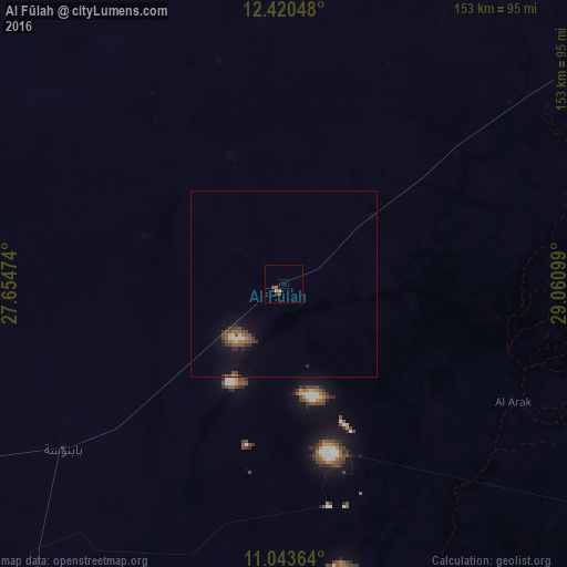
Analysis of Al Fūlah night lights 2016
Square area 10x10 km:
 0%
0%90-99
0%80-89
0%70-79
0.83%60-69
0.83%50-59
1.45%40-49
1.03%30-39
0.83%20-29
0%10-19
0%0-9
95.04%Square area 50x50 km:
0.09%90-99
0.08%80-89
0.13%70-79
0.09%60-69
0.27%50-59
0.49%40-49
0.4%30-39
0.45%20-29
0.25%10-19
1.08%0-9
96.68%Clear (daylight) street map image can be seen on geolist.org.
Map coordinates:
12° 25' 13.7" North, 27° 39' 17.1" East
11° 43' 58.5" North, 28° 21' 28.3" East
11° 2' 37.1" North, 29° 3' 39.6" East
Some cities around Al Fūlah sort by population:
• El Daein
245 km =152.2 mi,  262°
262°
• An Nuhūd
107.8 km =67 mi,  4°
4°
• Kadugli
168.6 km =104.8 mi,  118°
118°
• Dilling
144.9 km =90 mi,  75°
75°
• Al Mijlad
103.4 km =64.2 mi,  221°
221°
• Abū Zabad
118.8 km =73.8 mi,  54°
54°
• Al Lagowa
92.2 km =57.3 mi,  113°
113°
• El Fula
2.7 km =1.7 mi,  208°
208°
379535 (p: 11,238)
Sources (retrieved 2019-11-25):
» Earth at Night: Flat Maps 2012, 2016