Atbara night lights from space
Night Light of Atbara (River Nile) from space (Sudan) Src. Average luminocity for 10x10km area is 35.1178% and for 50x50km: 2.8978%.
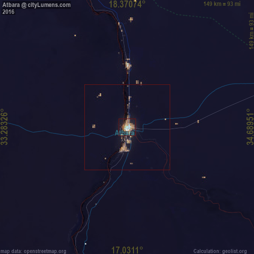
Analysis of Atbara night lights 2016
Square area 10x10 km:
 1.86%
1.86%90-99
5.37%80-89
3.31%70-79
4.75%60-69
7.02%50-59
13.02%40-49
3.51%30-39
3.1%20-29
5.79%10-19
39.67%0-9
12.6%Square area 50x50 km:
0.07%90-99
0.21%80-89
0.17%70-79
0.37%60-69
0.54%50-59
0.99%40-49
0.53%30-39
0.54%20-29
0.64%10-19
2.45%0-9
93.47%Clear (daylight) street map image can be seen on geolist.org.
Map coordinates:
18° 22' 14.7" North, 33° 16' 59.7" East
17° 42' 7.8" North, 33° 59' 11" East
17° 1' 52" North, 34° 41' 22.2" East
Some cities around Atbara sort by population:
• Omdurman
279.6 km =173.7 mi,  215°
215°
• Ed Damer
11.6 km =7.2 mi,  187°
187°
• Shendi
126.8 km =78.8 mi,  207°
207°
• Berber
35.5 km =22.1 mi,  359°
359°
• Kuraymah
244.6 km =152 mi,  292°
292°
• El Bauga
62.8 km =39 mi,  352°
352°
• El Matama
129.1 km =80.2 mi, 211°
• Merowe
245.3 km =152.4 mi, 290°
378231 (p: 107,930)
Sources (retrieved 2019-11-25):
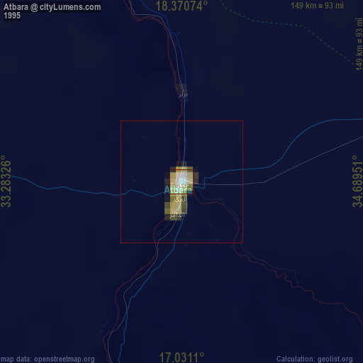
» NASA, Earths city lights 1995
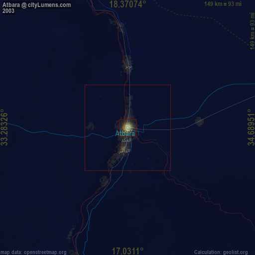
» NASA city lights 2003
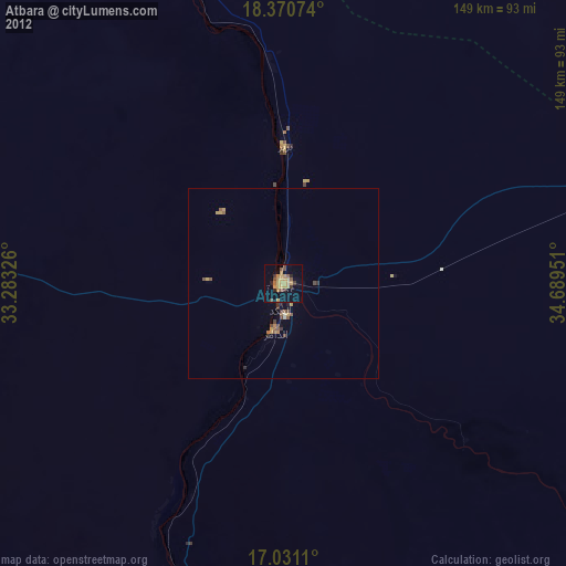
» Earth at Night: Flat Maps 2012, 2016