Turabah night lights from space
Night Light of Turabah (Makkah) from space (Saudi Arabia) Src. Average luminocity for 10x10km area is 66.869% and for 50x50km: 8.0714%.
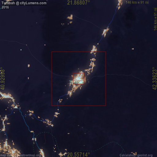
Analysis of Turabah night lights 2016
Square area 10x10 km:
 13.1%
13.1%90-99
17.46%80-89
4.56%70-79
7.94%60-69
16.27%50-59
13.1%40-49
9.52%30-39
11.11%20-29
3.97%10-19
2.98%0-9
0%Square area 50x50 km:
0.71%90-99
0.91%80-89
0.39%70-79
0.74%60-69
2.42%50-59
1.69%40-49
1.13%30-39
1.7%20-29
1.84%10-19
6.59%0-9
81.87%Clear (daylight) street map image can be seen on geolist.org.
Map coordinates:
21° 52' 5.1" North, 40° 55' 47.9" East
21° 12' 50.6" North, 41° 37' 59.2" East
20° 33' 25.7" North, 42° 20' 10.4" East
Some cities around Turabah sort by population:
• Ta’if
126.3 km =78.5 mi,  272°
272°
• Al Bahah
134.7 km =83.7 mi,  187°
187°
• Qal‘at Bīshah
168.6 km =104.8 mi,  143°
143°
• Ash Shafā
137.2 km =85.3 mi,  263°
263°
• Al Mindak
122.8 km =76.3 mi,  197°
197°
• Al Muwayh
136.2 km =84.6 mi,  5°
5°
• Al Hadā
141.1 km =87.7 mi,  276°
276°
• Tabālah
161.6 km =100.4 mi,  150°
150°
101322 (p: 23,235)
Sources (retrieved 2019-11-25):
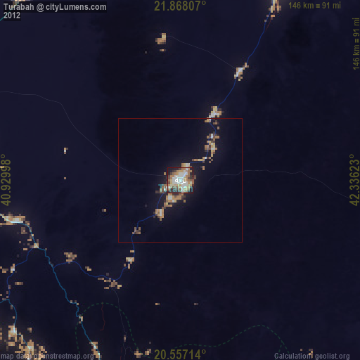
» Earth at Night: Flat Maps 2012, 2016