Tabālah night lights from space
Night Light of Tabālah ('Asir) from space (Saudi Arabia) Src. Average luminocity for 10x10km area is 15.5368% and for 50x50km: 24.4593%.
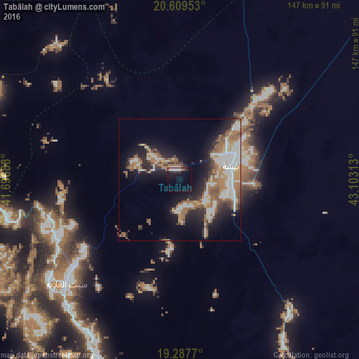
Analysis of Tabālah night lights 2016
Square area 10x10 km:
 2.6%
2.6%90-99
3.9%80-89
0.22%70-79
1.08%60-69
1.08%50-59
0.65%40-49
0.43%30-39
4.11%20-29
2.16%10-19
16.45%0-9
67.32%Square area 50x50 km:
4.91%90-99
4.76%80-89
1.52%70-79
2.21%60-69
6.12%50-59
3.53%40-49
2.28%30-39
3.15%20-29
5.55%10-19
11.81%0-9
54.14%Clear (daylight) street map image can be seen on geolist.org.
Map coordinates:
20° 36' 34.3" North, 41° 41' 48.8" East
19° 57' 0" North, 42° 24' 0" East
19° 17' 15.7" North, 43° 6' 11.3" East
Some cities around Tabālah sort by population:
• Khamis Mushait
186.8 km =116.1 mi,  169°
169°
• Abha
193.1 km =120 mi,  176°
176°
• Al Bahah
97.7 km =60.7 mi,  274°
274°
• Qal‘at Bīshah
22.2 km =13.8 mi,  75°
75°
• An Nimāş
94.1 km =58.5 mi,  198°
198°
• Turabah
161.6 km =100.4 mi,  330°
330°
• Al Majāridah
105.2 km =65.4 mi,  209°
209°
• Al Mindak
118.9 km =73.9 mi,  281°
281°
101633 (p: 5,151)
Sources (retrieved 2019-11-25):
» Earth at Night: Flat Maps 2012, 2016