Abha night lights from space
Night Light of Abha ('Asir) from space (Saudi Arabia) Src. Average luminocity for 10x10km area is 88.9329% and for 50x50km: 53.7298%.
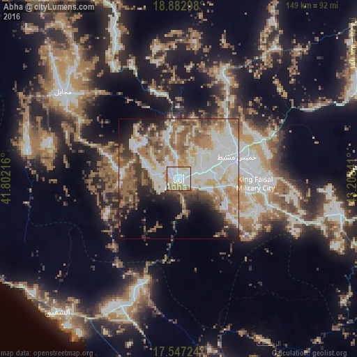
Analysis of Abha night lights 2016
Square area 10x10 km:
 38.96%
90-99
24.24%80-89
10.39%70-79
7.58%60-69
17.1%50-59
1.73%40-49
0%30-39
0%20-29
0%10-19
0%0-9
0%Square area 50x50 km:
14.1%90-99
12%80-89
4.95%70-79
5.87%60-69
11.57%50-59
8.61%40-49
5.35%30-39
5.72%20-29
5.59%10-19
7.28%0-9
18.95%Clear (daylight) street map image can be seen on geolist.org.
Map coordinates:
18° 52' 58.7" North, 41° 48' 7.8" East
18° 12' 59" North, 42° 30' 19" East
17° 32' 50.1" North, 43° 12' 30.3" East
Some cities around Abha sort by population:
• Khamis Mushait
25.8 km =16 mi,  68°
68°
• Jizan
147.7 km =91.8 mi,  178°
178°
• Şabyā
119.3 km =74.1 mi,  173°
173°
• Abū ‘Arīsh
143 km =88.9 mi, 165°
• An Nimāş
111 km =69 mi,  338°
338°
• Al Majāridah
118.7 km =73.8 mi,  328°
328°
• Mislīyah
84.3 km =52.4 mi, 176°
• Ad Darb
61 km =37.9 mi,  205°
205°
110690 (p: 210,886)
Sources (retrieved 2019-11-25):
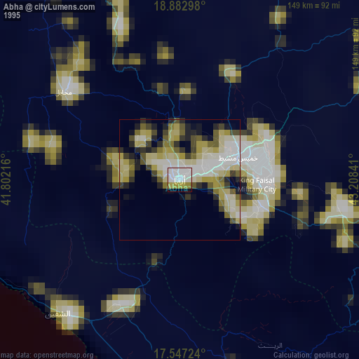
» NASA, Earths city lights 1995
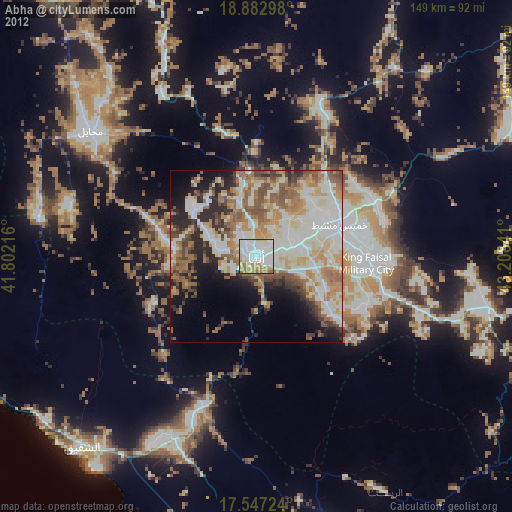
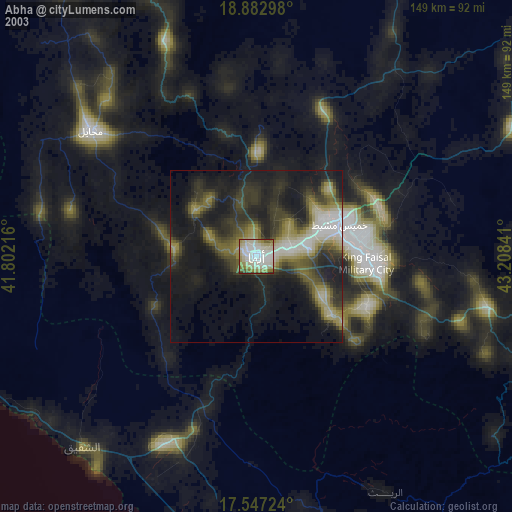
» NASA city lights 2003
» Earth at Night: Flat Maps 2012, 2016