Khamis Mushait night lights from space
Night Light of Khamis Mushait ('Asir) from space (Saudi Arabia) Src. Average luminocity for 10x10km area is 99.4545% and for 50x50km: 62.3832%.
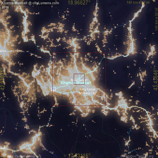
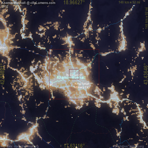
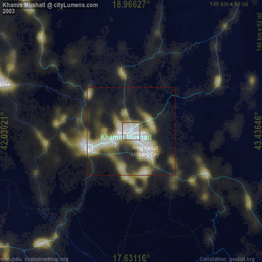
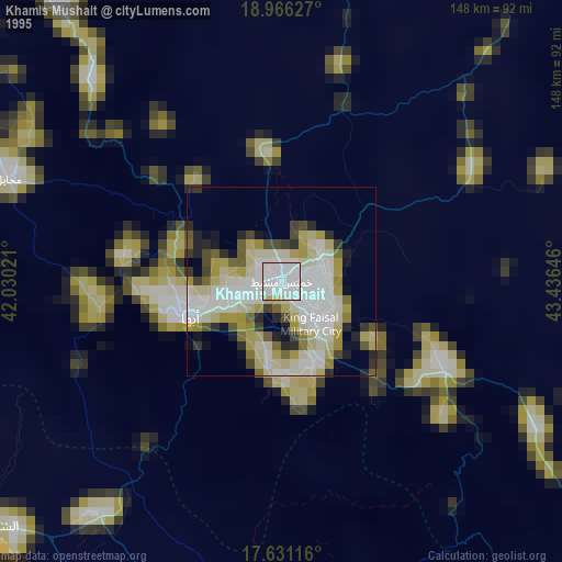
Analysis of Khamis Mushait night lights 2016
Square area 10x10 km:
 84.3%
84.3%90-99
14.46%80-89
1.24%70-79
0%60-69
0%50-59
0%40-49
0%30-39
0%20-29
0%10-19
0%0-9
0%Square area 50x50 km:
19.31%90-99
13.3%80-89
5.79%70-79
9%60-69
11.31%50-59
7.81%40-49
5.68%30-39
5.08%20-29
5.38%10-19
7.17%0-9
10.15%Clear (daylight) street map image can be seen on geolist.org.
Map coordinates:
18° 57' 58.6" North, 42° 1' 48.8" East
18° 18' 0" North, 42° 43' 60" East
17° 37' 52.2" North, 43° 26' 11.3" East
Some cities around Khamis Mushait sort by population:
• Abha
25.8 km =16 mi,  248°
248°
• Jizan
158.1 km =98.2 mi,  187°
187°
• Şabyā
128.4 km =79.8 mi, 185°
• Abū ‘Arīsh
148.4 km =92.2 mi,  175°
175°
• An Nimāş
114.1 km =70.9 mi,  325°
325°
• Al Majāridah
126 km =78.3 mi,  316°
316°
• Mislīyah
95.3 km =59.2 mi, 191°
• Ad Darb
81.9 km =50.9 mi,  218°
218°
105072 (p: 387,553)
Sources (retrieved 2019-11-25):
» NASA, Earths city lights 1995
» NASA city lights 2003
» Earth at Night: Flat Maps 2012, 2016