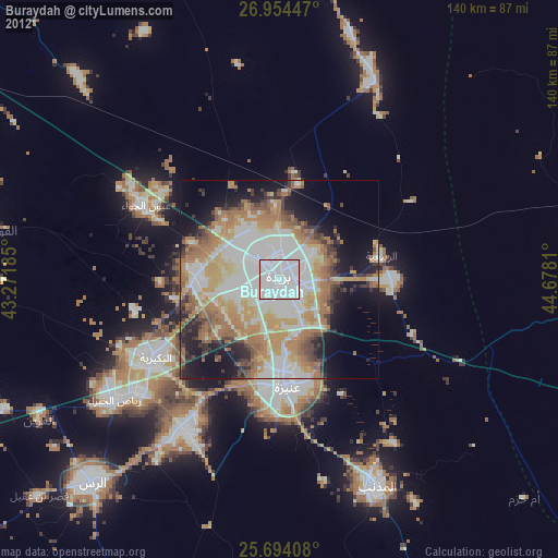
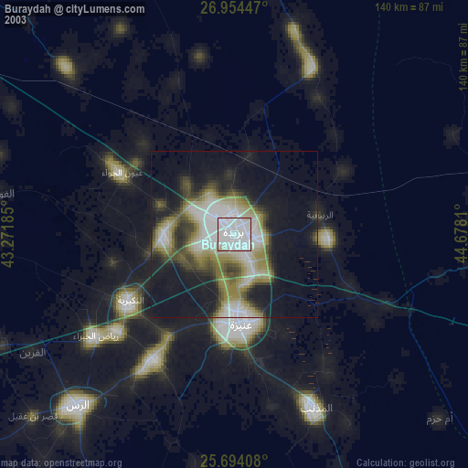
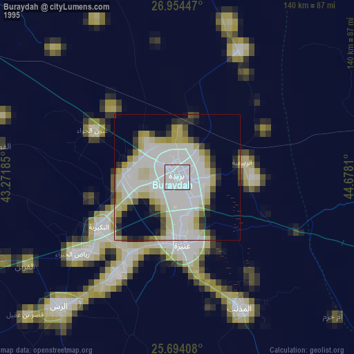
Buraydah night lights from space
Night Light of Buraydah (Al-Qassim) from space (Saudi Arabia) Src. Average luminocity for 10x10km area is 99.7879% and for 50x50km: 55.1367%.
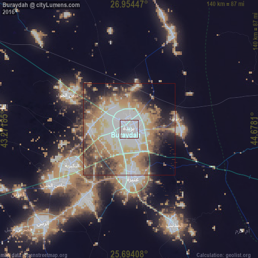
Analysis of Buraydah night lights 2016
Square area 10x10 km:
 93.94%
90-99
6.06%80-89
0%70-79
0%60-69
0%50-59
0%40-49
0%30-39
0%20-29
0%10-19
0%0-9
0%Square area 50x50 km:
16.2%90-99
9.68%80-89
5.5%70-79
6.94%60-69
12.31%50-59
6.04%40-49
6.54%30-39
7.71%20-29
6.91%10-19
7.44%0-9
14.75%Clear (daylight) street map image can be seen on geolist.org.
Map coordinates:
26° 57' 16.1" North, 43° 16' 18.7" East
26° 19' 33.6" North, 43° 58' 29.9" East
25° 41' 38.7" North, 44° 40' 41.2" East
Some cities around Buraydah sort by population:
• Ar Rass
69.7 km =43.3 mi,  223°
223°
• Al Mithnab
57.4 km =35.7 mi,  154°
154°
• Az Zulfī
83.8 km =52.1 mi,  92°
92°
• Al Bukayrīyah
37.8 km =23.5 mi,  236°
236°
• Adh Dhibiyah
88.1 km =54.7 mi,  247°
247°
• Tanūmah
87.5 km =54.4 mi,  10°
10°
• Al Arţāwīyah
138.2 km =85.9 mi,  81°
81°
• Al Fuwayliq
73.2 km =45.5 mi,  280°
280°
107304 (p: 391,336)
Sources (retrieved 2019-11-25):
» NASA, Earths city lights 1995
» NASA city lights 2003
» Earth at Night: Flat Maps 2012, 2016