Al Mithnab night lights from space
Night Light of Al Mithnab (Al-Qassim) from space (Saudi Arabia) Src. Average luminocity for 10x10km area is 78.2348% and for 50x50km: 13.4029%.
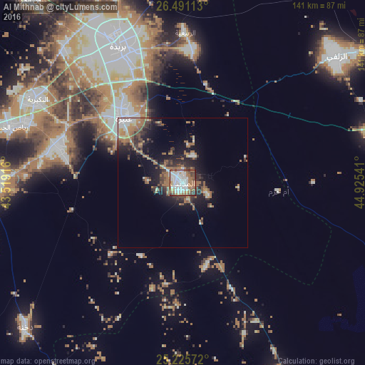

Analysis of Al Mithnab night lights 2016
Square area 10x10 km:
 32.39%
90-99
17.99%80-89
1.52%70-79
5.49%60-69
22.73%50-59
6.82%40-49
7.01%30-39
3.79%20-29
2.27%10-19
0%0-9
0%Square area 50x50 km:
2.42%90-99
1.58%80-89
0.53%70-79
1.08%60-69
4.46%50-59
1.91%40-49
1.68%30-39
2.47%20-29
3.43%10-19
7.89%0-9
72.53%Clear (daylight) street map image can be seen on geolist.org.
Map coordinates:
26° 29' 28.1" North, 43° 31' 9" East
25° 51' 36.4" North, 44° 13' 20.2" East
25° 13' 32.6" North, 44° 55' 31.5" East
Some cities around Al Mithnab sort by population:
• Buraydah
57.4 km =35.7 mi,  334°
334°
• Ar Rass
72.5 km =45 mi,  270°
270°
• Az Zulfī
76.8 km =47.7 mi,  50°
50°
• Al Bukayrīyah
64.4 km =40 mi,  298°
298°
• Adh Dhibiyah
108.1 km =67.2 mi,  279°
279°
• Sājir
84.3 km =52.4 mi,  153°
153°
• Al Arţāwīyah
133.2 km =82.8 mi,  57°
57°
• Al Fuwayliq
116.6 km =72.5 mi, 303°
109131 (p: 60,870)
Sources (retrieved 2019-11-25):
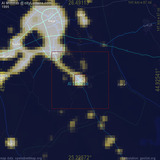
» NASA, Earths city lights 1995
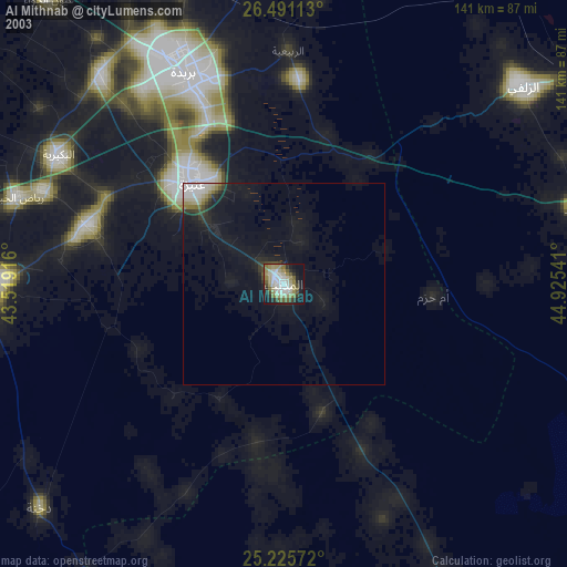
» NASA city lights 2003
» Earth at Night: Flat Maps 2012, 2016