Medina night lights from space
Night Light of Medina (Al Madīnah al Munawwarah) from space (Saudi Arabia) Src. Average luminocity for 10x10km area is 99.869% and for 50x50km: 44.002%.
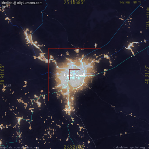
Analysis of Medina night lights 2016
Square area 10x10 km:
 91.27%
90-99
8.73%80-89
0%70-79
0%60-69
0%50-59
0%40-49
0%30-39
0%20-29
0%10-19
0%0-9
0%Square area 50x50 km:
14.08%90-99
8.48%80-89
2.23%70-79
4.13%60-69
10.3%50-59
3.76%40-49
4.89%30-39
5.88%20-29
6.52%10-19
10.64%0-9
29.08%Clear (daylight) street map image can be seen on geolist.org.
Map coordinates:
25° 6' 25" North, 38° 54' 39.8" East
24° 28' 7" North, 39° 36' 51" East
23° 49' 37.3" North, 40° 19' 2.3" East
Some cities around Medina sort by population:
• Sulţānah
3.9 km =2.4 mi,  312°
312°
• Yanbu
162.9 km =101.2 mi,  255°
255°
• Rābigh
194.8 km =121 mi,  197°
197°
• Umm Lajj
244.7 km =152 mi,  284°
284°
• Al-`Ula
292.2 km =181.6 mi,  324°
324°
• Badr Ḩunayn
113.1 km =70.3 mi,  227°
227°
• Al Jumūm
316.9 km =196.9 mi,  178°
178°
• Al Muwayh
314.7 km =195.5 mi,  135°
135°
109223 (p: 1,300,000)
Sources (retrieved 2019-11-25):
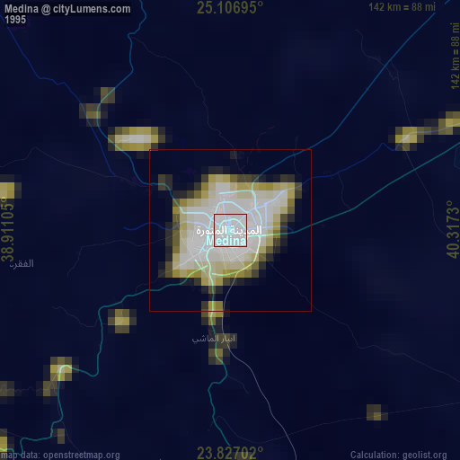
» NASA, Earths city lights 1995
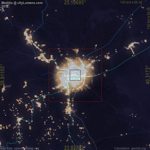
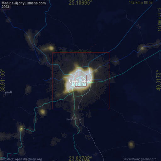
» NASA city lights 2003
» Earth at Night: Flat Maps 2012, 2016