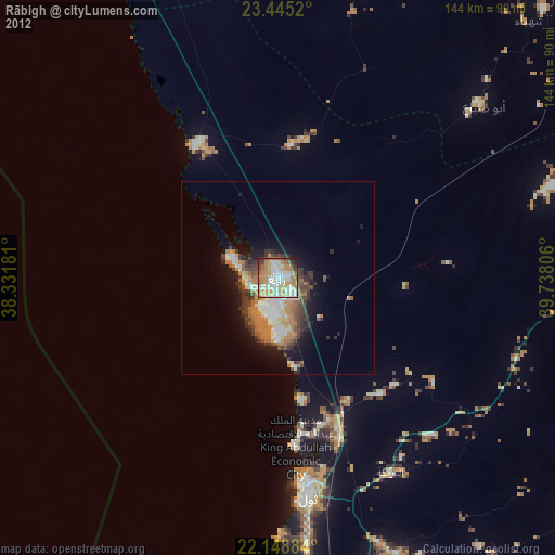
Rābigh night lights from space
Night Light of Rābigh (Makkah) from space (Saudi Arabia) Src. Average luminocity for 10x10km area is 82.006% and for 50x50km: 17.0549%.
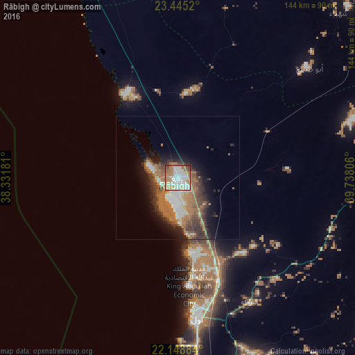
Analysis of Rābigh night lights 2016
Square area 10x10 km:
 18.85%
90-99
30.56%80-89
8.53%70-79
10.32%60-69
21.63%50-59
4.37%40-49
4.17%30-39
1.19%20-29
0.4%10-19
0%0-9
0%Square area 50x50 km:
2.19%90-99
3.17%80-89
0.94%70-79
1.36%60-69
6.72%50-59
2.16%40-49
2.59%30-39
3.52%20-29
3.1%10-19
6.05%0-9
68.18%Clear (daylight) street map image can be seen on geolist.org.
Map coordinates:
23° 26' 42.7" North, 38° 19' 54.5" East
22° 47' 54.8" North, 39° 2' 5.7" East
22° 8' 55.8" North, 39° 44' 17" East
Some cities around Rābigh sort by population:
• Jeddah
146.3 km =90.9 mi,  173°
173°
• Mecca
172.9 km =107.4 mi,  151°
151°
• Medina
194.8 km =121 mi,  17°
17°
• Sulţānah
196.5 km =122.1 mi, 16°
• Yanbu
174.5 km =108.4 mi,  325°
325°
• Badr Ḩunayn
112.3 km =69.8 mi,  347°
347°
• Al Jumūm
147.7 km =91.8 mi, 152°
• Al Hadā
205.1 km =127.4 mi,  141°
141°
103035 (p: 41,759)
Sources (retrieved 2019-11-25):
» Earth at Night: Flat Maps 2012, 2016