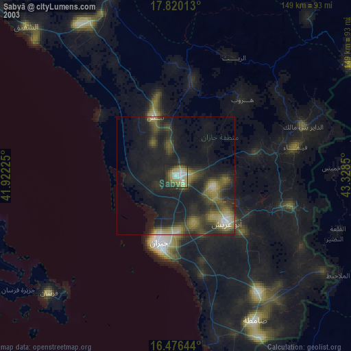
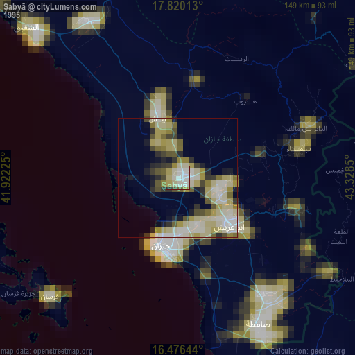
Şabyā night lights from space
Night Light of Şabyā (Jizan) from space (Saudi Arabia) Src. Average luminocity for 10x10km area is 86.0579% and for 50x50km: 51.7401%.

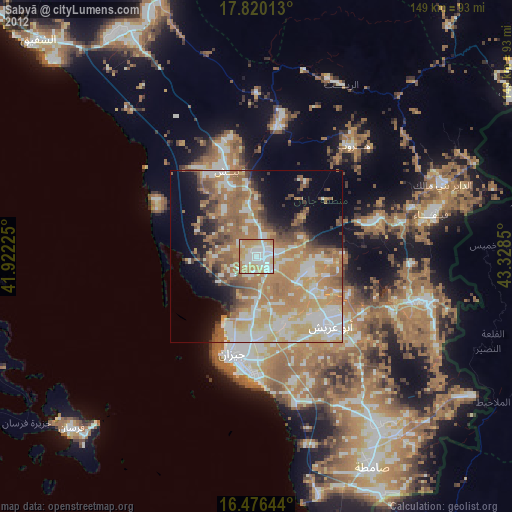
Analysis of Şabyā night lights 2016
Square area 10x10 km:
 27.69%
90-99
24.17%80-89
6.4%70-79
24.38%60-69
17.36%50-59
0%40-49
0%30-39
0%20-29
0%10-19
0%0-9
0%Square area 50x50 km:
8.48%90-99
9.21%80-89
4.32%70-79
9.99%60-69
16.54%50-59
9.03%40-49
6.63%30-39
5.07%20-29
4.89%10-19
9.16%0-9
16.68%Clear (daylight) street map image can be seen on geolist.org.
Map coordinates:
17° 49' 12.5" North, 41° 55' 20.1" East
17° 8' 58.2" North, 42° 37' 31.3" East
16° 28' 35.2" North, 43° 19' 42.6" East
Some cities around Şabyā sort by population:
• Jizan
30 km =18.6 mi,  195°
195°
• Abū ‘Arīsh
29.8 km =18.5 mi,  132°
132°
• Şāmitah
70.3 km =43.7 mi,  151°
151°
• Farasān
73.4 km =45.6 mi,  227°
227°
• Al Jarādīyah
70.4 km =43.7 mi, 154°
• Mislīyah
35.3 km =21.9 mi,  348°
348°
• Mizhirah
37.7 km =23.4 mi,  162°
162°
• Ad Darb
75 km =46.6 mi,  328°
328°
102651 (p: 54,108)
Sources (retrieved 2019-11-25):
» NASA, Earths city lights 1995
» NASA city lights 2003
» Earth at Night: Flat Maps 2012, 2016