Al Mubarraz night lights from space
Night Light of Al Mubarraz (Eastern Province) from space (Saudi Arabia) Src. Average luminocity for 10x10km area is 97.4107% and for 50x50km: 36.2737%.
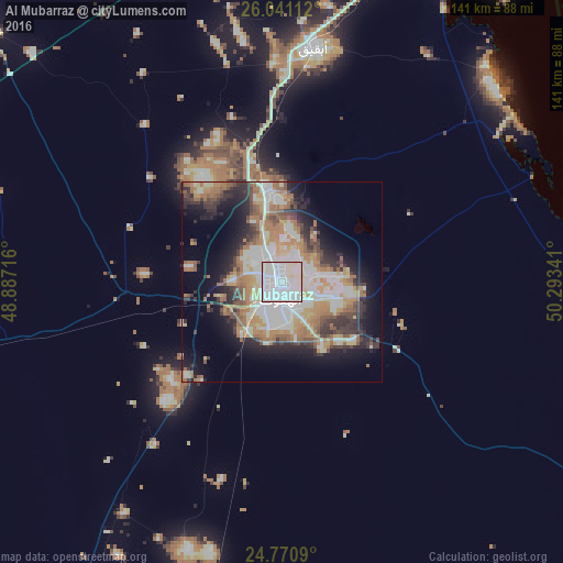
Analysis of Al Mubarraz night lights 2016
Square area 10x10 km:
 52.18%
90-99
37.9%80-89
9.92%70-79
0%60-69
0%50-59
0%40-49
0%30-39
0%20-29
0%10-19
0%0-9
0%Square area 50x50 km:
7.31%90-99
8.26%80-89
4.24%70-79
4.53%60-69
7.05%50-59
4.14%40-49
3.4%30-39
4.96%20-29
6.61%10-19
10.85%0-9
38.65%Clear (daylight) street map image can be seen on geolist.org.
Map coordinates:
26° 2' 28" North, 48° 53' 13.8" East
25° 24' 27.6" North, 49° 35' 25" East
24° 46' 15.2" North, 50° 17' 36.3" East
Some cities around Al Mubarraz sort by population:
• Al Hufūf
4.8 km =3 mi,  183°
183°
• Al Baţţālīyah
5.2 km =3.2 mi,  56°
56°
• Al Qurayn
8.5 km =5.3 mi,  6°
6°
• Al Jubayl
6.1 km =3.8 mi,  98°
98°
• Al Qārah
7.7 km =4.8 mi,  82°
82°
• Al Jafr
13.6 km =8.5 mi, 104°
• Al Markaz
14.4 km =8.9 mi,  93°
93°
• Julayjilah
10.3 km =6.4 mi, 5°
109101 (p: 290,802)
Sources (retrieved 2019-11-25):
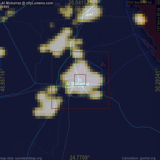
» NASA, Earths city lights 1995
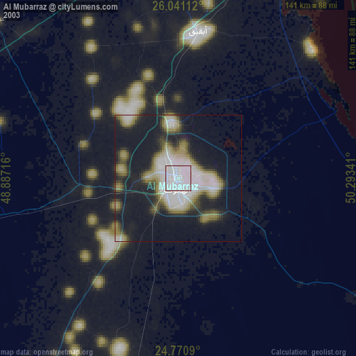
» NASA city lights 2003
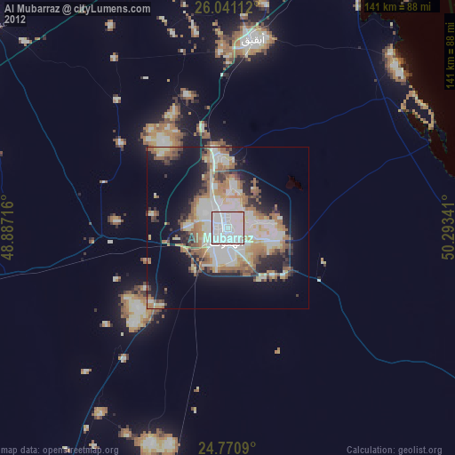
» Earth at Night: Flat Maps 2012, 2016