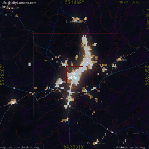
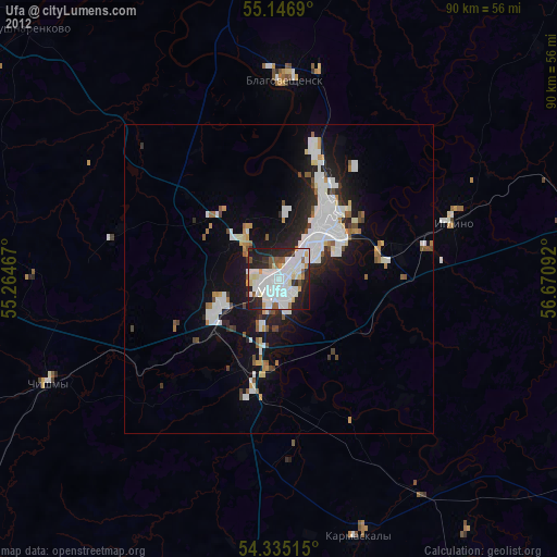
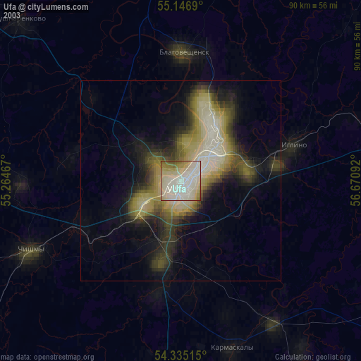
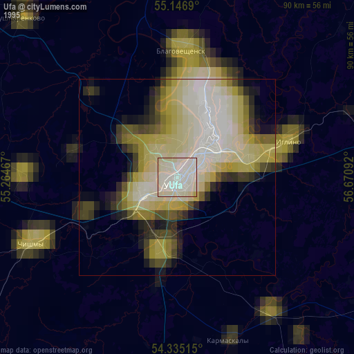
Ufa night lights from space
Night Light of Ufa (Bashkortostan Republic) from space (Russia) Src. Average luminocity for 10x10km area is 70.7293% and for 50x50km: 13.7923%.
Analysis of Ufa night lights 2016
Square area 10x10 km:
 26.57%
90-99
24.06%80-89
1.38%70-79
5.39%60-69
5.01%50-59
5.01%40-49
2.13%30-39
13.53%20-29
16.54%10-19
0.38%0-9
0%Square area 50x50 km:
3.35%90-99
3.21%80-89
0.75%70-79
1.11%60-69
1%50-59
1.25%40-49
1.17%30-39
2.28%20-29
4.61%10-19
8.3%0-9
72.96%Clear (daylight) street map image can be seen on geolist.org.
Map coordinates:
55° 8' 48.8" North, 55° 15' 52.8" East
54° 44' 35" North, 55° 58' 4" East
54° 20' 6.5" North, 56° 40' 15.3" East
Some cities around Ufa sort by population:
• Birsk
80.1 km =49.8 mi,  340°
340°
• Blagoveshchensk
32.5 km =20.2 mi,  1°
1°
• Chishmy
42.3 km =26.3 mi,  244°
244°
• Iglino
30.2 km =18.8 mi,  70°
70°
• Kushnarënkovo
56.3 km =35 mi,  315°
315°
• Tolbazy
80.1 km =49.8 mi,  183°
183°
• Karmaskaly
43.7 km =27.2 mi,  161°
161°
• Yazykovo
54.1 km =33.6 mi,  11°
11°
479561 (p: 1,033,338)
Sources (retrieved 2019-11-25):
» NASA, Earths city lights 1995
» NASA city lights 2003
» Earth at Night: Flat Maps 2012, 2016