Yazykovo night lights from space
Night Light of Yazykovo (Bashkortostan Republic) from space (Russia) Src. Average luminocity for 10x10km area is 0% and for 50x50km: 0.5685%.
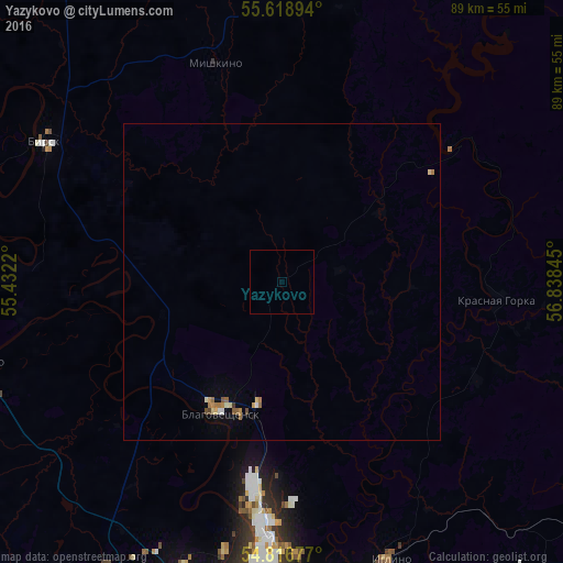
Analysis of Yazykovo night lights 2016
Square area 10x10 km:
 0%
0%90-99
0%80-89
0%70-79
0%60-69
0%50-59
0%40-49
0%30-39
0%20-29
0%10-19
0%0-9
100%Square area 50x50 km:
0.02%90-99
0.08%80-89
0.08%70-79
0.09%60-69
0.15%50-59
0.09%40-49
0.06%30-39
0.02%20-29
0%10-19
0.06%0-9
99.34%Clear (daylight) street map image can be seen on geolist.org.
Map coordinates:
55° 37' 8.2" North, 55° 25' 55.9" East
55° 13' 11.6" North, 56° 8' 7.2" East
54° 49' 0.4" North, 56° 50' 18.4" East
Some cities around Yazykovo sort by population:
• Ufa
54.1 km =33.6 mi,  191°
191°
• Birsk
43.7 km =27.2 mi,  300°
300°
• Blagoveshchensk
22.9 km =14.2 mi,  205°
205°
• Asha
76.4 km =47.5 mi,  108°
108°
• Iglino
46.6 km =29 mi,  157°
157°
• Kushnarënkovo
51.4 km =31.9 mi,  255°
255°
• Burayevo
82.8 km =51.4 mi,  326°
326°
• Karaidel’
83.8 km =52.1 mi,  35°
35°
468483 (p: 5,929)
Sources (retrieved 2019-11-25):
» Earth at Night: Flat Maps 2012, 2016