Iglino night lights from space
Night Light of Iglino (Bashkortostan Republic) from space (Russia) Src. Average luminocity for 10x10km area is 6.3971% and for 50x50km: 7.0947%.
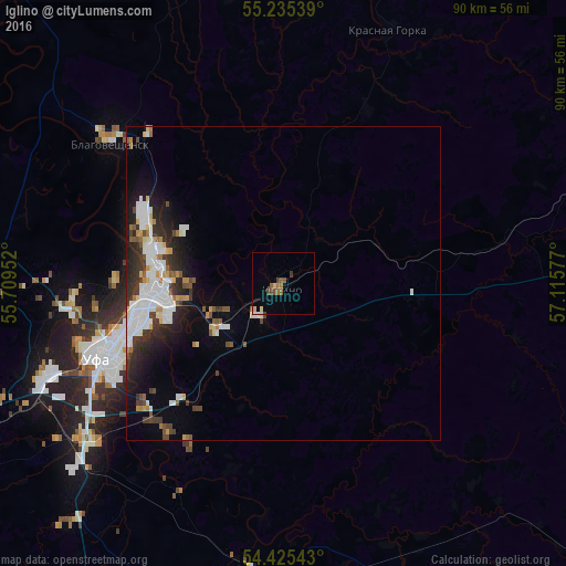
Analysis of Iglino night lights 2016
Square area 10x10 km:
 0.24%
0.24%90-99
0.6%80-89
1.44%70-79
0%60-69
1.32%50-59
1.79%40-49
2.63%30-39
0.48%20-29
0%10-19
0%0-9
91.51%Square area 50x50 km:
1.77%90-99
1.6%80-89
0.42%70-79
0.58%60-69
0.51%50-59
0.68%40-49
0.74%30-39
1.29%20-29
1.95%10-19
3.04%0-9
87.42%Clear (daylight) street map image can be seen on geolist.org.
Map coordinates:
55° 14' 7.4" North, 55° 42' 34.3" East
54° 49' 56.8" North, 56° 24' 45.5" East
54° 25' 31.5" North, 57° 6' 56.8" East
Some cities around Iglino sort by population:
• Ufa
30.2 km =18.8 mi,  250°
250°
• Blagoveshchensk
35.7 km =22.2 mi,  309°
309°
• Asha
57.9 km =36 mi,  71°
71°
• Chishmy
72.4 km =45 mi, 246°
• Sim
84.1 km =52.3 mi,  77°
77°
• Kushnarënkovo
74.2 km =46.1 mi,  294°
294°
• Karmaskaly
53.4 km =33.2 mi,  196°
196°
• Yazykovo
46.6 km =29 mi,  337°
337°
557563 (p: 13,958)
Sources (retrieved 2019-11-25):
» Earth at Night: Flat Maps 2012, 2016