Suoyarvi night lights from space
Night Light of Suoyarvi (Karelia) from space (Russia) Src. Average luminocity for 10x10km area is 6.5632% and for 50x50km: 0.5194%.
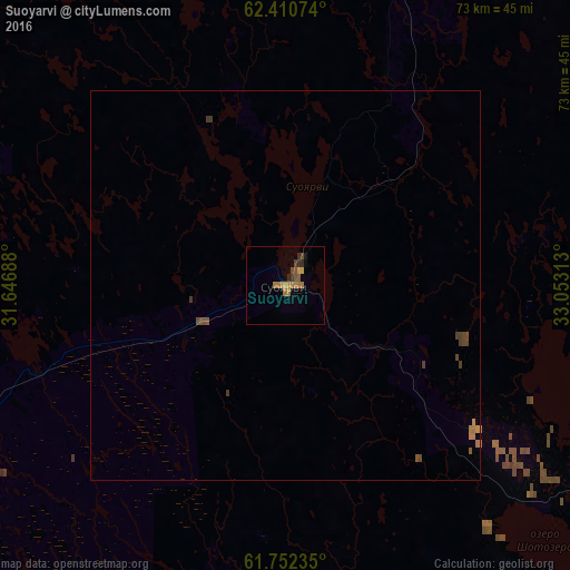
Analysis of Suoyarvi night lights 2016
Square area 10x10 km:
 0%
0%90-99
0%80-89
0.3%70-79
1.68%60-69
3.16%50-59
1.09%40-49
1.19%30-39
0.69%20-29
1.38%10-19
0.59%0-9
89.92%Square area 50x50 km:
0%90-99
0%80-89
0.01%70-79
0.1%60-69
0.21%50-59
0.1%40-49
0.21%30-39
0.16%20-29
0.06%10-19
0.02%0-9
99.14%Clear (daylight) street map image can be seen on geolist.org.
Map coordinates:
62° 24' 38.7" North, 31° 38' 48.8" East
62° 4' 60" North, 32° 21' 0" East
61° 45' 8.5" North, 33° 3' 11.3" East
Some cities around Suoyarvi sort by population:
• Petrozavodsk
109.6 km =68.1 mi,  107°
107°
• Kondopoga
100.2 km =62.3 mi,  82°
82°
• Sortavala
95.3 km =59.2 mi,  244°
244°
• Pitkyaranta
72.8 km =45.2 mi,  218°
218°
• Olonets
126.5 km =78.6 mi,  164°
164°
• Kitee, FI
114.5 km =71.1 mi,  270°
270°
• Lakhdenpokh’ya
129.2 km =80.3 mi, 240°
• Ilomantsi, FI
98.1 km =61 mi,  311°
311°
486186 (p: 10,833)
Sources (retrieved 2019-11-25):
» Earth at Night: Flat Maps 2012, 2016