Olonets night lights from space
Night Light of Olonets (Karelia) from space (Russia) Src. Average luminocity for 10x10km area is 0% and for 50x50km: 0.0103%.
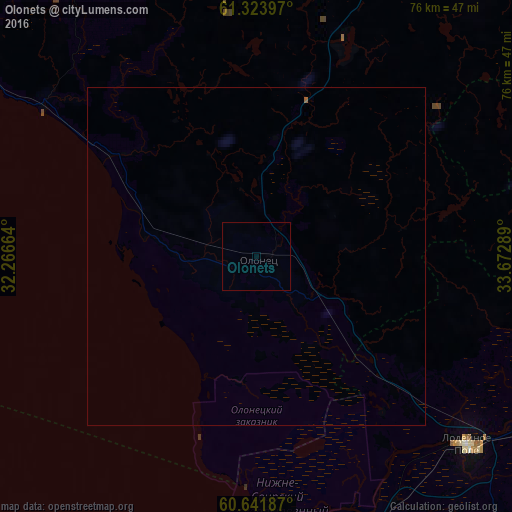
Analysis of Olonets night lights 2016
Square area 10x10 km:
 0%
0%90-99
0%80-89
0%70-79
0%60-69
0%50-59
0%40-49
0%30-39
0%20-29
0%10-19
0%0-9
100%Square area 50x50 km:
0%90-99
0%80-89
0%70-79
0%60-69
0%50-59
0.02%40-49
0%30-39
0%20-29
0%10-19
0%0-9
99.98%Clear (daylight) street map image can be seen on geolist.org.
Map coordinates:
61° 19' 26.3" North, 32° 15' 59.9" East
60° 59' 5.1" North, 32° 58' 11.1" East
60° 38' 30.7" North, 33° 40' 22.4" East
Some cities around Olonets sort by population:
• Petrozavodsk
115.3 km =71.6 mi,  39°
39°
• Volkhov
122.7 km =76.2 mi,  196°
196°
• Lodeynoye Pole
42.7 km =26.5 mi,  132°
132°
• Podporozh’ye
65.4 km =40.6 mi,  97°
97°
• Syas’stroy
96.8 km =60.1 mi,  193°
193°
• Pitkyaranta
103.1 km =64.1 mi,  309°
309°
• Suoyarvi
126.5 km =78.6 mi,  344°
344°
• Novaya Ladoga
104.7 km =65.1 mi, 200°
515403 (p: 10,005)
Sources (retrieved 2019-11-25):
» Earth at Night: Flat Maps 2012, 2016