Ilomantsi night lights from space
Night Light of Ilomantsi (North Karelia) from space (Finland) Src. Average luminocity for 10x10km area is 5.1746% and for 50x50km: 0.2253%.
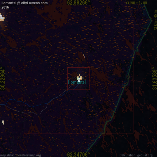
Analysis of Ilomantsi night lights 2016
Square area 10x10 km:
 0.69%
0.69%90-99
1.29%80-89
1.09%70-79
0.89%60-69
0.79%50-59
0%40-49
0%30-39
0%20-29
0%10-19
0%0-9
95.24%Square area 50x50 km:
0.03%90-99
0.05%80-89
0.04%70-79
0.04%60-69
0.03%50-59
0%40-49
0.02%30-39
0.02%20-29
0%10-19
0%0-9
99.78%Clear (daylight) street map image can be seen on geolist.org.
Map coordinates:
62° 59' 33.6" North, 30° 13' 46.7" East
62° 40' 17.8" North, 30° 55' 57.9" East
62° 20' 49.4" North, 31° 38' 9.2" East
Some cities around Ilomantsi sort by population:
• Joensuu
60.3 km =37.5 mi,  262°
262°
• Lieksa
85.3 km =53 mi,  327°
327°
• Kontiolahti
56.2 km =34.9 mi,  280°
280°
• Liperi
81.6 km =50.7 mi, 259°
• Kitee
75.3 km =46.8 mi,  212°
212°
• Outokumpu
97.9 km =60.8 mi,  273°
273°
• Pyhäselkä
56.2 km =34.9 mi,  241°
241°
• Eno
42.3 km =26.3 mi,  290°
290°
656709 (p: 6,408)
Sources (retrieved 2019-11-25):
» Earth at Night: Flat Maps 2012, 2016