Petrozavodsk night lights from space
Night Light of Petrozavodsk (Karelia) from space (Russia) Src. Average luminocity for 10x10km area is 55.2451% and for 50x50km: 4.0665%.
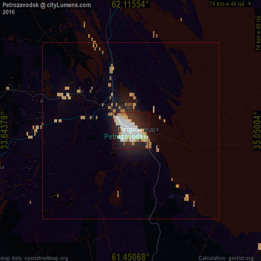
Analysis of Petrozavodsk night lights 2016
Square area 10x10 km:
 14.82%
90-99
16.01%80-89
9.98%70-79
4.25%60-69
4.35%50-59
0.79%40-49
0.2%30-39
5.83%20-29
21.34%10-19
17.49%0-9
4.94%Square area 50x50 km:
0.61%90-99
0.66%80-89
0.69%70-79
0.56%60-69
0.89%50-59
0.15%40-49
0.04%30-39
0.33%20-29
1.23%10-19
2.35%0-9
92.48%Clear (daylight) street map image can be seen on geolist.org.
Map coordinates:
62° 6' 55.9" North, 33° 38' 37.6" East
61° 47' 5.7" North, 34° 20' 48.9" East
61° 27' 2.4" North, 35° 3' 0.1" East
Some cities around Petrozavodsk sort by population:
• Kondopoga
47 km =29.2 mi,  354°
354°
• Lodeynoye Pole
125.2 km =77.8 mi,  199°
199°
• Podporozh’ye
97.6 km =60.6 mi,  185°
185°
• Medvezh’yegorsk
126 km =78.3 mi,  2°
2°
• Suoyarvi
109.6 km =68.1 mi,  287°
287°
• Pudozh
114.6 km =71.2 mi,  88°
88°
• Olonets
115.3 km =71.6 mi,  219°
219°
• Pindushi
126.2 km =78.4 mi,  5°
5°
509820 (p: 265,025)
Sources (retrieved 2019-11-25):
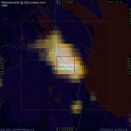
» NASA, Earths city lights 1995
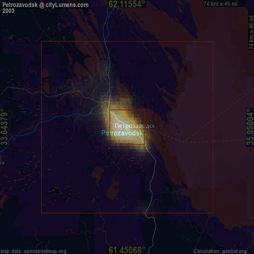
» NASA city lights 2003
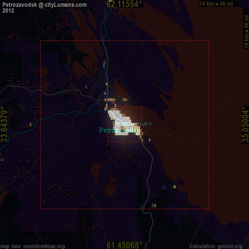
» Earth at Night: Flat Maps 2012, 2016