Stroitel’ night lights from space
Night Light of Stroitel’ (Belgorod Oblast) from space (Russia) Src. Average luminocity for 10x10km area is 8.6779% and for 50x50km: 5.9851%.
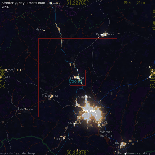
Analysis of Stroitel’ night lights 2016
Square area 10x10 km:
 0.7%
0.7%90-99
1.82%80-89
0%70-79
1.54%60-69
2.1%50-59
1.68%40-49
0.28%30-39
1.4%20-29
0%10-19
0.56%0-9
89.92%Square area 50x50 km:
1.79%90-99
1.29%80-89
0.37%70-79
0.59%60-69
0.52%50-59
0.44%40-49
0.48%30-39
0.92%20-29
1.65%10-19
2.36%0-9
89.6%Clear (daylight) street map image can be seen on geolist.org.
Map coordinates:
51° 13' 40.3" North, 35° 46' 47.9" East
50° 47' 7.5" North, 36° 28' 59.2" East
50° 20' 19.6" North, 37° 11' 10.4" East
Some cities around Stroitel’ sort by population:
• Belgorod
20.6 km =12.8 mi,  160°
160°
• Razumnoye
31.3 km =19.4 mi,  153°
153°
• Borisovka
38.8 km =24.1 mi,  238°
238°
• Prokhorovka
33 km =20.5 mi,  31°
31°
• Tomarovka
20.9 km =13 mi, 237°
• Ivnya
39.4 km =24.5 mi,  321°
321°
• Severnyy
13 km =8.1 mi, 157°
• Mayskiy
29.6 km =18.4 mi,  183°
183°
487147 (p: 18,636)
Sources (retrieved 2019-11-25):
» Earth at Night: Flat Maps 2012, 2016