Belgorod night lights from space
Night Light of Belgorod (Belgorod Oblast) from space (Russia) Src. Average luminocity for 10x10km area is 74.2513% and for 50x50km: 9.1934%.
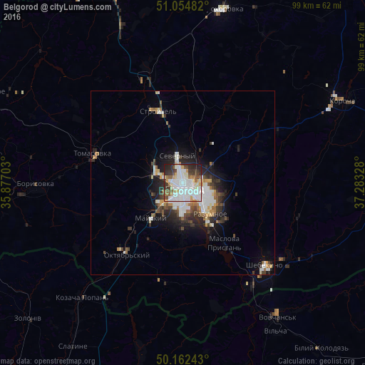
Analysis of Belgorod night lights 2016
Square area 10x10 km:
 31.15%
90-99
18.98%80-89
5.75%70-79
6.95%60-69
4.14%50-59
5.35%40-49
6.55%30-39
8.69%20-29
10.83%10-19
1.6%0-9
0%Square area 50x50 km:
2.33%90-99
1.93%80-89
0.6%70-79
0.82%60-69
1.02%50-59
0.75%40-49
1.07%30-39
1.58%20-29
2.65%10-19
4.05%0-9
83.2%Clear (daylight) street map image can be seen on geolist.org.
Map coordinates:
51° 3' 17.4" North, 35° 52' 37.3" East
50° 36' 38.7" North, 36° 34' 48.5" East
50° 9' 44.7" North, 37° 16' 59.8" East
Some cities around Belgorod sort by population:
• Shebekino
32.5 km =20.2 mi,  133°
133°
• Stroitel’
20.6 km =12.8 mi,  340°
340°
• Razumnoye
11.2 km =7 mi,  139°
139°
• Tomarovka
25.8 km =16 mi,  288°
288°
• Severnyy
7.6 km =4.7 mi,  345°
345°
• Mayskiy
13.2 km =8.2 mi,  220°
220°
• Maslova Pristan’
19.7 km =12.2 mi,  149°
149°
• Novaya Tavolzhanka
33.8 km =21 mi, 148°
578072 (p: 345,289)
Sources (retrieved 2019-11-25):
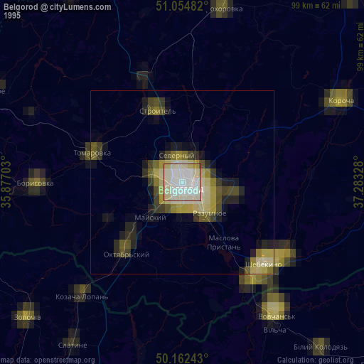
» NASA, Earths city lights 1995
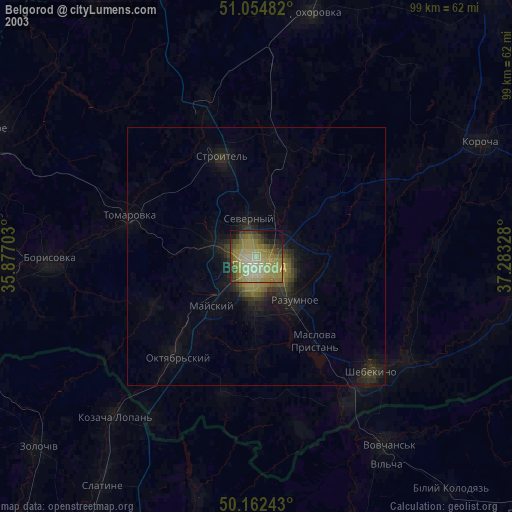
» NASA city lights 2003
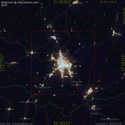
» Earth at Night: Flat Maps 2012, 2016