Prokop’yevsk night lights from space
Night Light of Prokop’yevsk (Kemerovo Oblast) from space (Russia) Src. Average luminocity for 10x10km area is 41.881% and for 50x50km: 8.9676%.
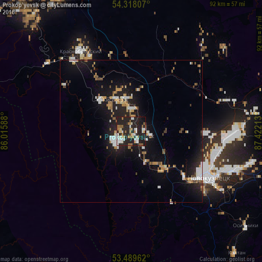
Analysis of Prokop’yevsk night lights 2016
Square area 10x10 km:
 7.94%
7.94%90-99
9.26%80-89
2.25%70-79
6.75%60-69
5.16%50-59
3.57%40-49
0.79%30-39
0.79%20-29
33.07%10-19
29.37%0-9
1.06%Square area 50x50 km:
1.31%90-99
1.41%80-89
0.62%70-79
1.24%60-69
1.19%50-59
0.92%40-49
0.86%30-39
0.47%20-29
3.19%10-19
8.9%0-9
79.89%Clear (daylight) street map image can be seen on geolist.org.
Map coordinates:
54° 19' 5.1" North, 86° 0' 57.2" East
53° 54' 21.2" North, 86° 43' 8.4" East
53° 29' 22.6" North, 87° 25' 19.7" East
Some cities around Prokop’yevsk sort by population:
• Novokuznetsk
30.6 km =19 mi,  123°
123°
• Kiselëvsk
10.1 km =6.3 mi,  338°
338°
• Osinniki
52.5 km =32.6 mi,  126°
126°
• Kaltan
53.9 km =33.5 mi,  139°
139°
• Bachatskiy
57.7 km =35.9 mi,  318°
318°
• Krasnobrodskiy
33.1 km =20.6 mi,  327°
327°
• Abagur
40.1 km =24.9 mi, 119°
• Tayzhina
54 km =33.6 mi, 119°
1494114 (p: 219,000)
Sources (retrieved 2019-11-25):
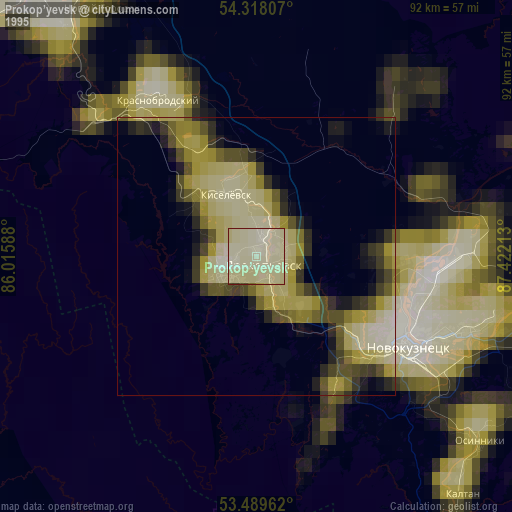
» NASA, Earths city lights 1995
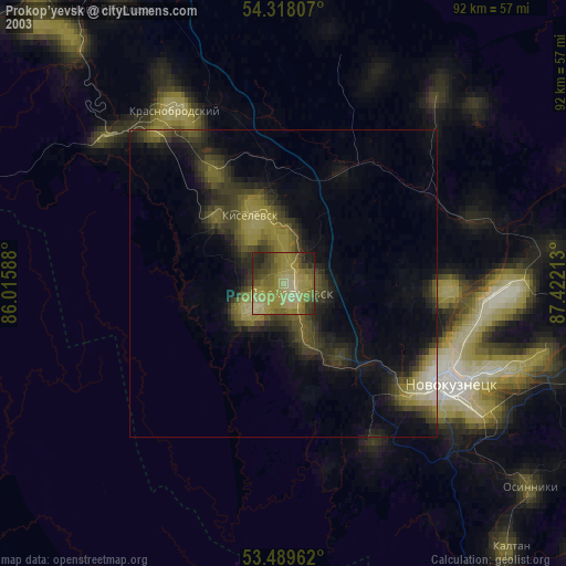
» NASA city lights 2003
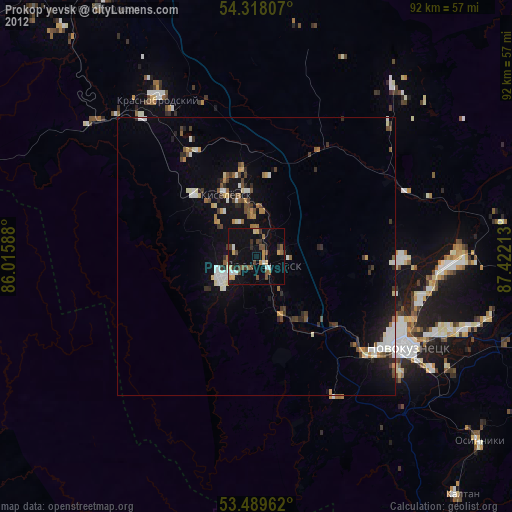
» Earth at Night: Flat Maps 2012, 2016