Novokuznetsk night lights from space
Night Light of Novokuznetsk (Kemerovo Oblast) from space (Russia) Src. Average luminocity for 10x10km area is 63.9634% and for 50x50km: 13.8722%.
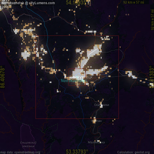
Analysis of Novokuznetsk night lights 2016
Square area 10x10 km:
 25.51%
90-99
18.56%80-89
2.9%70-79
2.02%60-69
3.91%50-59
4.55%40-49
7.83%30-39
7.32%20-29
14.27%10-19
12.5%0-9
0.63%Square area 50x50 km:
3.39%90-99
3.26%80-89
0.85%70-79
0.93%60-69
0.93%50-59
1.09%40-49
1.18%30-39
2.11%20-29
4.55%10-19
9.61%0-9
72.12%Clear (daylight) street map image can be seen on geolist.org.
Map coordinates:
54° 10' 9.7" North, 86° 24' 24.4" East
53° 45' 20.5" North, 87° 6' 35.6" East
53° 20' 16.5" North, 87° 48' 46.9" East
Some cities around Novokuznetsk sort by population:
• Prokop’yevsk
30.6 km =19 mi,  303°
303°
• Kiselëvsk
39.2 km =24.4 mi,  311°
311°
• Osinniki
22 km =13.7 mi,  131°
131°
• Myski
45.8 km =28.5 mi,  96°
96°
• Kaltan
26.2 km =16.3 mi,  159°
159°
• Abagur
9.8 km =6.1 mi,  106°
106°
• Mundybash
61.8 km =38.4 mi,  168°
168°
• Tayzhina
23.6 km =14.7 mi, 114°
1496990 (p: 539,616)
Sources (retrieved 2019-11-25):
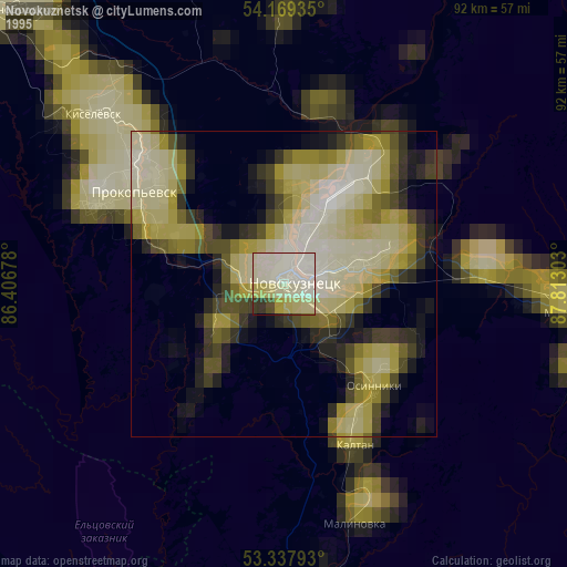
» NASA, Earths city lights 1995
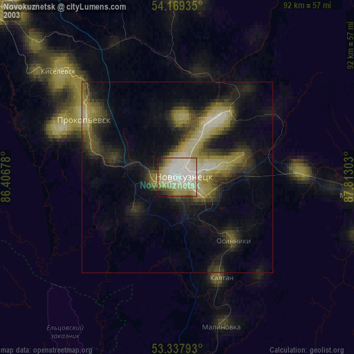
» NASA city lights 2003
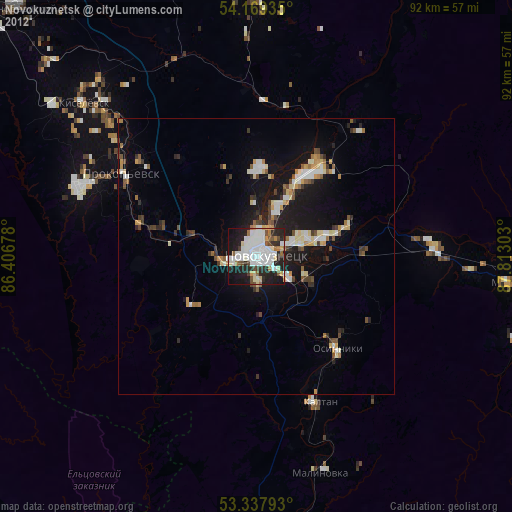
» Earth at Night: Flat Maps 2012, 2016