Poykovskiy night lights from space
Night Light of Poykovskiy (Khanty-Mansia) from space (Russia) Src. Average luminocity for 10x10km area is 51.3419% and for 50x50km: 11.6067%.
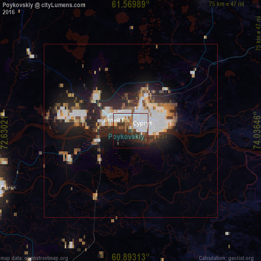
Analysis of Poykovskiy night lights 2016
Square area 10x10 km:
 21.07%
90-99
13.22%80-89
0.83%70-79
1.76%60-69
1.86%50-59
5.58%40-49
4.13%30-39
7.54%20-29
14.15%10-19
18.18%0-9
11.67%Square area 50x50 km:
2.84%90-99
2.33%80-89
0.76%70-79
0.88%60-69
1.23%50-59
1.16%40-49
1.45%30-39
1.57%20-29
4.06%10-19
7.01%0-9
76.72%Clear (daylight) street map image can be seen on geolist.org.
Map coordinates:
61° 34' 11.6" North, 72° 37' 48.8" East
61° 13' 60" North, 73° 19' 60" East
60° 53' 35.3" North, 74° 2' 11.3" East
Some cities around Poykovskiy sort by population:
• Surgut
4.8 km =3 mi,  67°
67°
• Nefteyugansk
41.9 km =26 mi,  249°
249°
• Pyt-Yakh
59.5 km =37 mi,  205°
205°
• Langepas
100.5 km =62.4 mi,  88°
88°
• Lyantor
75.9 km =47.2 mi,  304°
304°
• Fedorovskiy
46.2 km =28.7 mi,  26°
26°
• Solnechniy
9.6 km =6 mi, 302°
• Barsovo
8.1 km =5 mi,  285°
285°
1494276 (p: 28,080)
Sources (retrieved 2019-11-25):
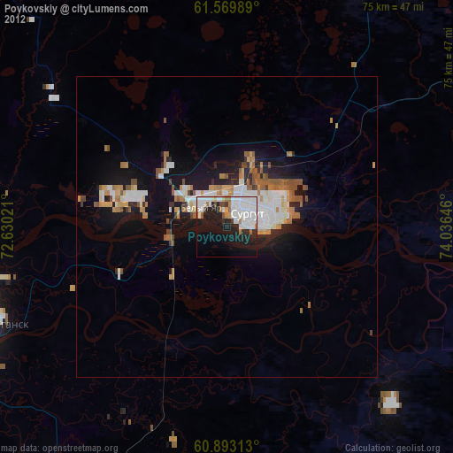
» Earth at Night: Flat Maps 2012, 2016