Barsovo night lights from space
Night Light of Barsovo (Khanty-Mansia) from space (Russia) Src. Average luminocity for 10x10km area is 6.7608% and for 50x50km: 11.5976%.
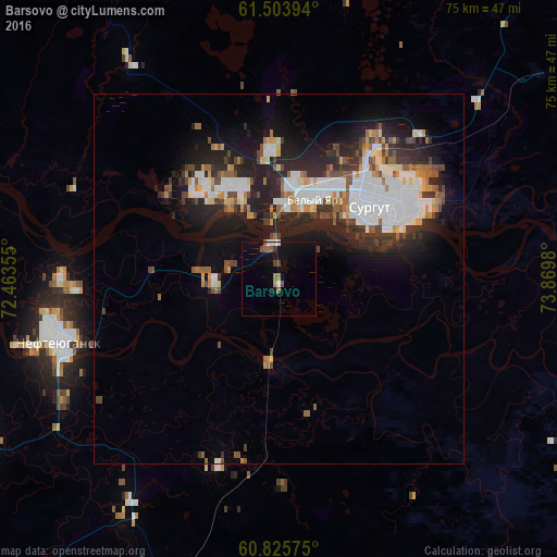
Analysis of Barsovo night lights 2016
Square area 10x10 km:
 0.54%
0.54%90-99
0.76%80-89
0%70-79
0.32%60-69
0.97%50-59
1.95%40-49
1.73%30-39
0%20-29
0.43%10-19
4.33%0-9
88.96%Square area 50x50 km:
2.79%90-99
2.31%80-89
0.75%70-79
0.86%60-69
1.22%50-59
1.25%40-49
1.5%30-39
1.6%20-29
4.02%10-19
6.96%0-9
76.74%Clear (daylight) street map image can be seen on geolist.org.
Map coordinates:
61° 30' 14.2" North, 72° 27' 48.8" East
61° 15' 9.9" North, 73° 11' 17.7" East
60° 49' 32.7" North, 73° 52' 11.3" East
Some cities around Barsovo sort by population:
• Surgut
12.2 km =7.6 mi,  91°
91°
• Nefteyugansk
35.7 km =22.2 mi,  241°
241°
• Pyt-Yakh
58.7 km =36.5 mi,  197°
197°
• Langepas
108.2 km =67.2 mi, 89°
• Lyantor
68.4 km =42.5 mi,  306°
306°
• Poykovskiy
8.1 km =5 mi,  105°
105°
• Fedorovskiy
48.2 km =30 mi,  35°
35°
• Solnechniy
3 km =1.9 mi,  352°
352°
1510842 (p: 5,710)
Sources (retrieved 2019-11-25):
» Earth at Night: Flat Maps 2012, 2016