Nizhnesortymskiy night lights from space
Night Light of Nizhnesortymskiy (Khanty-Mansia) from space (Russia) Src. Average luminocity for 10x10km area is 8.1937% and for 50x50km: 0.3679%.
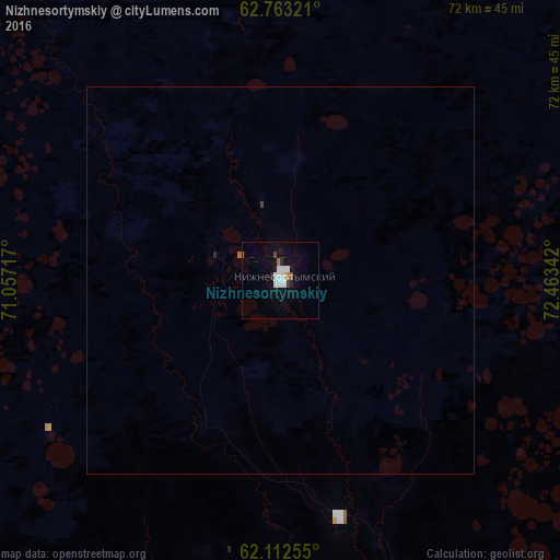
Analysis of Nizhnesortymskiy night lights 2016
Square area 10x10 km:
 2.08%
2.08%90-99
2.27%80-89
0.2%70-79
0.2%60-69
0.79%50-59
0.59%40-49
0.4%30-39
0.4%20-29
0.89%10-19
1.28%0-9
90.91%Square area 50x50 km:
0.08%90-99
0.09%80-89
0.01%70-79
0.01%60-69
0.05%50-59
0.03%40-49
0.02%30-39
0.03%20-29
0.05%10-19
0.05%0-9
99.58%Clear (daylight) street map image can be seen on geolist.org.
Map coordinates:
62° 45' 47.6" North, 71° 3' 25.8" East
62° 26' 22.7" North, 71° 45' 37" East
62° 6' 45.2" North, 72° 27' 48.3" East
Some cities around Nizhnesortymskiy sort by population:
• Surgut
158.3 km =98.4 mi,  146°
146°
• Nefteyugansk
155.4 km =96.6 mi,  163°
163°
• Kogalym
141.6 km =88 mi,  97°
97°
• Lyantor
93.5 km =58.1 mi,  167°
167°
• Poykovskiy
157.5 km =97.9 mi, 148°
• Fedorovskiy
137.7 km =85.6 mi,  132°
132°
• Solnechniy
149 km =92.6 mi, 149°
• Barsovo
151.7 km =94.3 mi, 150°
7287775 (p: 15,204)
Sources (retrieved 2019-11-25):
» Earth at Night: Flat Maps 2012, 2016