Kogalym night lights from space
Night Light of Kogalym (Khanty-Mansia) from space (Russia) Src. Average luminocity for 10x10km area is 40.9907% and for 50x50km: 4.0226%.
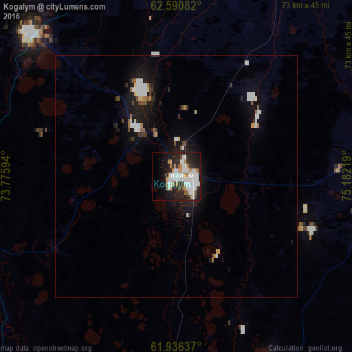
Analysis of Kogalym night lights 2016
Square area 10x10 km:
 12.63%
90-99
11.08%80-89
1.86%70-79
4.24%60-69
4.04%50-59
2.07%40-49
1.86%30-39
2.8%20-29
16.67%10-19
17.29%0-9
25.47%Square area 50x50 km:
0.95%90-99
0.8%80-89
0.21%70-79
0.3%60-69
0.32%50-59
0.31%40-49
0.26%30-39
0.34%20-29
1.14%10-19
3.74%0-9
91.62%Clear (daylight) street map image can be seen on geolist.org.
Map coordinates:
62° 35' 27" North, 73° 46' 33.4" East
62° 15' 55.3" North, 74° 28' 44.6" East
61° 56' 10.9" North, 75° 10' 55.9" East
Some cities around Kogalym sort by population:
• Surgut
126 km =78.3 mi,  206°
206°
• Noyabrsk
114.1 km =70.9 mi,  25°
25°
• Langepas
118.8 km =73.8 mi,  161°
161°
• Poykovskiy
129.6 km =80.5 mi, 207°
• Fedorovskiy
83.5 km =51.9 mi, 208°
• Pokachi
76.4 km =47.5 mi,  142°
142°
• Solnechniy
129.1 km =80.2 mi, 211°
• Novoagansk
119 km =73.9 mi,  107°
107°
6695754 (p: 57,800)
Sources (retrieved 2019-11-25):
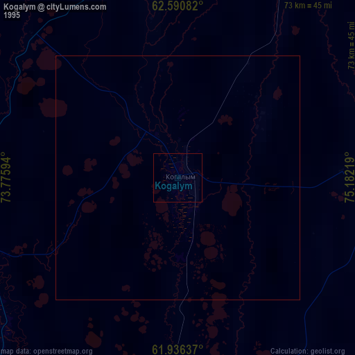
» NASA, Earths city lights 1995
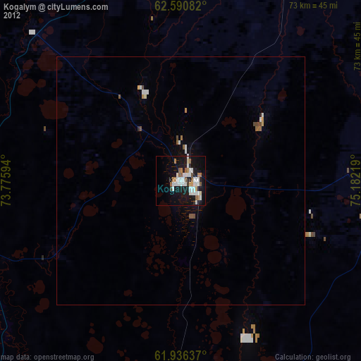
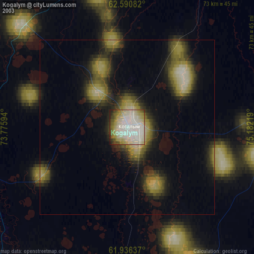
» NASA city lights 2003
» Earth at Night: Flat Maps 2012, 2016