Ibresi night lights from space
Night Light of Ibresi (Chuvashia) from space (Russia) Src. Average luminocity for 10x10km area is 0.6124% and for 50x50km: 0.0313%.
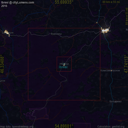
Analysis of Ibresi night lights 2016
Square area 10x10 km:
 0%
0%90-99
0%80-89
0%70-79
0%60-69
0%50-59
0%40-49
0.48%30-39
0.96%20-29
0%10-19
0%0-9
98.56%Square area 50x50 km:
0%90-99
0%80-89
0%70-79
0%60-69
0%50-59
0%40-49
0.02%30-39
0.04%20-29
0%10-19
0%0-9
99.94%Clear (daylight) street map image can be seen on geolist.org.
Map coordinates:
55° 41' 57.7" North, 46° 20' 5.6" East
55° 18' 4" North, 47° 2' 16.8" East
54° 53' 55.7" North, 47° 44' 28.1" East
Some cities around Ibresi sort by population:
• Kanash
36.8 km =22.9 mi,  50°
50°
• Alatyr’
58.7 km =36.5 mi,  209°
209°
• Shumerlya
45.3 km =28.1 mi,  299°
299°
• Tsivil’sk
69 km =42.9 mi,  23°
23°
• Vurnary
21.6 km =13.4 mi,  347°
347°
• Poretskoye
46.4 km =28.8 mi,  255°
255°
• Batyrevo
44.7 km =27.8 mi,  125°
125°
• Turgenevo
67.8 km =42.1 mi,  221°
221°
557628 (p: 9,113)
Sources (retrieved 2019-11-25):
» Earth at Night: Flat Maps 2012, 2016