San Isidro de Curuguaty night lights from space
Night Light of San Isidro de Curuguaty (Canindeyú) from space (Paraguay) Src. Average luminocity for 10x10km area is 15.1151% and for 50x50km: 0.8141%.
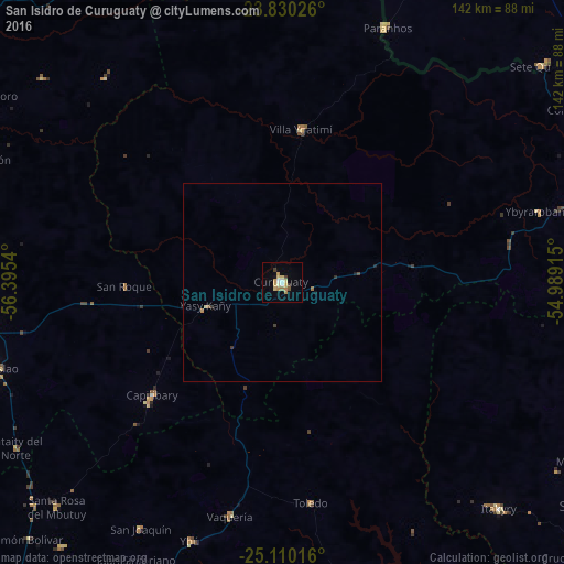
Analysis of San Isidro de Curuguaty night lights 2016
Square area 10x10 km:
 0.99%
0.99%90-99
1.98%80-89
4.56%70-79
2.38%60-69
2.78%50-59
0.6%40-49
0.6%30-39
1.98%20-29
0%10-19
2.38%0-9
81.75%Square area 50x50 km:
0.04%90-99
0.08%80-89
0.21%70-79
0.12%60-69
0.15%50-59
0.06%40-49
0.06%30-39
0.17%20-29
0.06%10-19
0.16%0-9
98.89%Clear (daylight) street map image can be seen on geolist.org.
Map coordinates:
23° 49' 48.9" South, 56° 23' 43.4" West
24° 28' 18.6" South, 55° 41' 32.2" West
25° 6' 36.6" South, 54° 59' 20.9" West
Some cities around San Isidro de Curuguaty sort by population:
• Caaguazú
115.8 km =72 mi,  196°
196°
• Coronel Oviedo
131.8 km =81.9 mi,  214°
214°
• Nueva Esperanza
84.8 km =52.7 mi,  92°
92°
• Colonia General Alfredo Stroessner
99.2 km =61.6 mi,  180°
180°
• Lima
103.5 km =64.3 mi,  309°
309°
• Doctor Juan León Mallorquín
115.4 km =71.7 mi,  157°
157°
• Repatriación
120.9 km =75.1 mi,  192°
192°
• Paranhos, BR
69.6 km =43.2 mi,  22°
22°
3437088 (p: 11,095)
Sources (retrieved 2019-11-25):
» Earth at Night: Flat Maps 2012, 2016