Lima night lights from space
Night Light of Lima (San Pedro) from space (Paraguay) Src. Average luminocity for 10x10km area is 8.5496% and for 50x50km: 1.6647%.
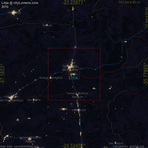
Analysis of Lima night lights 2016
Square area 10x10 km:
 0%
0%90-99
0%80-89
2.18%70-79
2.18%60-69
0.4%50-59
0.79%40-49
1.79%30-39
0.6%20-29
1.59%10-19
8.13%0-9
82.34%Square area 50x50 km:
0.04%90-99
0.02%80-89
0.45%70-79
0.26%60-69
0.23%50-59
0.2%40-49
0.32%30-39
0.36%20-29
0.28%10-19
1.03%0-9
96.8%Clear (daylight) street map image can be seen on geolist.org.
Map coordinates:
23° 14' 19.6" South, 57° 11' 7.1" West
23° 52' 59.8" South, 56° 28' 55.8" West
24° 31' 28.5" South, 55° 46' 44.6" West
Some cities around Lima sort by population:
• Concepción
110.7 km =68.8 mi,  299°
299°
• San Isidro de Curuguaty
103.5 km =64.3 mi,  129°
129°
• Horqueta
84.1 km =52.3 mi,  315°
315°
• San Pedro de Ycuamandiyú
65.5 km =40.7 mi,  249°
249°
• Capitán Bado
118.5 km =73.6 mi,  54°
54°
• Benjamín Aceval
163 km =101.3 mi,  222°
222°
• Paranhos, BR
106.9 km =66.4 mi,  90°
90°
• Puerto Rosario
91.3 km =56.7 mi,  227°
227°
3437846 (p: 10,367)
Sources (retrieved 2019-11-25):
» Earth at Night: Flat Maps 2012, 2016