Colonia General Alfredo Stroessner night lights from space
Night Light of Colonia General Alfredo Stroessner (Caaguazú) from space (Paraguay) Src. Average luminocity for 10x10km area is 20.9544% and for 50x50km: 1.7312%.
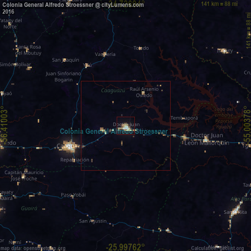
Analysis of Colonia General Alfredo Stroessner night lights 2016
Square area 10x10 km:
 2.18%
2.18%90-99
2.58%80-89
3.57%70-79
0.4%60-69
7.94%50-59
0.79%40-49
2.58%30-39
2.98%20-29
1.98%10-19
13.69%0-9
61.31%Square area 50x50 km:
0.09%90-99
0.1%80-89
0.33%70-79
0.08%60-69
0.47%50-59
0.12%40-49
0.37%30-39
0.51%20-29
0.28%10-19
0.57%0-9
97.08%Clear (daylight) street map image can be seen on geolist.org.
Map coordinates:
24° 43' 37" South, 56° 24' 36.1" West
25° 21' 50.2" South, 55° 42' 24.8" West
25° 59' 51.4" South, 55° 0' 13.6" West
Some cities around Colonia General Alfredo Stroessner sort by population:
• Caaguazú
33.3 km =20.7 mi,  249°
249°
• Coronel Oviedo
74.2 km =46.1 mi,  263°
263°
• Villarrica
84.7 km =52.6 mi,  239°
239°
• Santa Rita
79.4 km =49.3 mi,  125°
125°
• San Isidro de Curuguaty
99.2 km =61.6 mi,  0°
0°
• San Juan Nepomuceno
86.4 km =53.7 mi,  195°
195°
• Doctor Juan León Mallorquín
46.1 km =28.6 mi,  99°
99°
• Repatriación
30.8 km =19.1 mi,  232°
232°
3439032 (p: 11,558)
Sources (retrieved 2019-11-25):
» Earth at Night: Flat Maps 2012, 2016