Filadelfia night lights from space
Night Light of Filadelfia (Boquerón) from space (Paraguay) Src. Average luminocity for 10x10km area is 20.5663% and for 50x50km: 2.0183%.
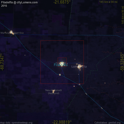
Analysis of Filadelfia night lights 2016
Square area 10x10 km:
 0.57%
0.57%90-99
2.84%80-89
7.01%70-79
3.6%60-69
3.03%50-59
1.52%40-49
1.14%30-39
1.52%20-29
1.52%10-19
11.74%0-9
65.53%Square area 50x50 km:
0.05%90-99
0.16%80-89
0.63%70-79
0.23%60-69
0.4%50-59
0.18%40-49
0.18%30-39
0.25%20-29
0.18%10-19
1%0-9
96.75%Clear (daylight) street map image can be seen on geolist.org.
Map coordinates:
21° 41' 15" South, 60° 44' 4.9" West
22° 20' 21.7" South, 60° 1' 53.7" West
22° 59' 17.5" South, 59° 19' 42.4" West
Some cities around Filadelfia sort by population:
• Concepción
291.2 km =180.9 mi,  113°
113°
• Porto Murtinho, BR
232.7 km =144.6 mi,  72°
72°
• Horqueta
324.3 km =201.5 mi, 110°
• Ingeniero Guillermo N. Juárez, AR
254.3 km =158 mi,  226°
226°
• Las Lomitas, AR
269.7 km =167.6 mi,  192°
192°
• Ibarreta, AR
320.2 km =199 mi,  176°
176°
• Colonia Menno
22.3 km =13.9 mi,  97°
97°
• Fuerte Olimpo
265.6 km =165 mi,  57°
57°
3867291 (p: 8,048)
Sources (retrieved 2019-11-25):
» Earth at Night: Flat Maps 2012, 2016