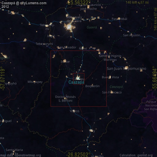
Caazapá night lights from space
Night Light of Caazapá from space (Paraguay) Src. Average luminocity for 10x10km area is 13.5873% and for 50x50km: 1.1015%.
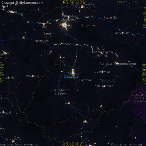
Analysis of Caazapá night lights 2016
Square area 10x10 km:
 0.4%
0.4%90-99
1.19%80-89
3.97%70-79
1.79%60-69
1.39%50-59
2.38%40-49
3.17%30-39
1.98%20-29
1.19%10-19
0.79%0-9
81.75%Square area 50x50 km:
0.02%90-99
0.05%80-89
0.3%70-79
0.13%60-69
0.12%50-59
0.17%40-49
0.37%30-39
0.34%20-29
0.16%10-19
0.11%0-9
98.24%Clear (daylight) street map image can be seen on geolist.org.
Map coordinates:
25° 33' 47.6" South, 57° 4' 16.3" West
26° 11' 45" South, 56° 22' 5" West
26° 49' 30.1" South, 55° 39' 53.8" West
Some cities around Caazapá sort by population:
• Caaguazú
88 km =54.7 mi,  23°
23°
• Coronel Oviedo
83.9 km =52.1 mi,  355°
355°
• Villarrica
50.1 km =31.1 mi,  352°
352°
• San Juan Nepomuceno
43.9 km =27.3 mi,  77°
77°
• Repatriación
84.7 km =52.6 mi,  29°
29°
• San Pedro del Paraná
72.6 km =45.1 mi,  167°
167°
• Quiindy
89.8 km =55.8 mi,  285°
285°
• San José
82.2 km =51.1 mi,  333°
333°
3439297 (p: 23,996)
Sources (retrieved 2019-11-25):
» Earth at Night: Flat Maps 2012, 2016