Quiindy night lights from space
Night Light of Quiindy (Paraguarí) from space (Paraguay) Src. Average luminocity for 10x10km area is 8.9087% and for 50x50km: 1.2443%.
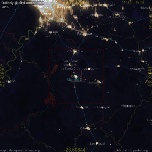
Analysis of Quiindy night lights 2016
Square area 10x10 km:
 0.2%
0.2%90-99
0.6%80-89
3.97%70-79
1.19%60-69
0.79%50-59
0.4%40-49
1.79%30-39
2.18%20-29
0%10-19
0%0-9
88.89%Square area 50x50 km:
0.02%90-99
0.05%80-89
0.37%70-79
0.19%60-69
0.32%50-59
0.09%40-49
0.19%30-39
0.41%20-29
0.1%10-19
0.07%0-9
98.19%Clear (daylight) street map image can be seen on geolist.org.
Map coordinates:
25° 20' 32.2" South, 57° 56' 12" West
25° 58' 33.8" South, 57° 14' 0.7" West
26° 36' 23.2" South, 56° 31' 49.5" West
Some cities around Quiindy sort by population:
• Itauguá
66 km =41 mi,  349°
349°
• Itá
54.5 km =33.9 mi, 345°
• Piribebuy
60 km =37.3 mi,  18°
18°
• Paraguarí
40.4 km =25.1 mi,  12°
12°
• Ypacarai
63.4 km =39.4 mi, 354°
• Guarambaré
58.3 km =36.2 mi,  337°
337°
• Yaguarón
46.4 km =28.8 mi, 353°
• Carapeguá
19.6 km =12.2 mi,  0°
0°
3437215 (p: 5,137)
Sources (retrieved 2019-11-25):
» Earth at Night: Flat Maps 2012, 2016