Sobrado night lights from space
Night Light of Sobrado (Porto) from space (Portugal) Src. Average luminocity for 10x10km area is 76.1039% and for 50x50km: 62.6785%.
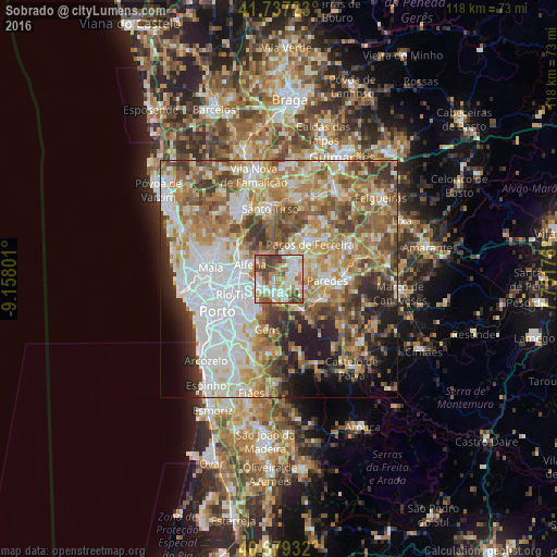
Analysis of Sobrado night lights 2016
Square area 10x10 km:
100  17.37%
90-99 24.03%
80-89 6.98%
70-79 10.23%
60-69 14.45%
50-59 8.6%
40-49 15.42%
30-39 2.92%
20-29 0%
10-19 0%
0-9 0%
17.37%90-99
24.03%80-89
6.98%70-79
10.23%60-69
14.45%50-59
8.6%40-49
15.42%30-39
2.92%20-29
0%10-19
0%0-9
0%Square area 50x50 km:
100 14.99%
90-99 13.19%
80-89 7.83%
70-79 10.16%
60-69 11.7%
50-59 9.29%
40-49 7.55%
30-39 6.42%
20-29 6.17%
10-19 6.38%
0-9 6.31%
14.99%90-99
13.19%80-89
7.83%70-79
10.16%60-69
11.7%50-59
9.29%40-49
7.55%30-39
6.42%20-29
6.17%10-19
6.38%0-9
6.31%Clear (daylight) street map image can be seen on geolist.org.
Map coordinates:
41° 44' 14" North, 9° 9' 28.8" West
41° 12' 37.5" North, 8° 27' 17.6" West
40° 40' 45.6" North, 7° 45' 6.3" West
Some cities around Sobrado sort by population:
• Fânzeres
7.9 km =4.9 mi,  232°
232°
• Valongo
4.4 km =2.7 mi,  236°
236°
• Baguim do Monte
7.5 km =4.7 mi,  254°
254°
• Alfena
6.5 km =4 mi,  296°
296°
• Rebordosa
4.3 km =2.7 mi,  69°
69°
• Lordelo
5.1 km =3.2 mi,  58°
58°
• Campo
2.9 km =1.8 mi,  196°
196°
• Gandra
2 km =1.2 mi,  120°
120°
2733941 (p: 6,703)
Sources (retrieved 2019-11-25):
» Earth at Night: Flat Maps 2012, 2016