Gandra night lights from space
Night Light of Gandra (Porto) from space (Portugal) Src. Average luminocity for 10x10km area is 76.4416% and for 50x50km: 62.2423%.
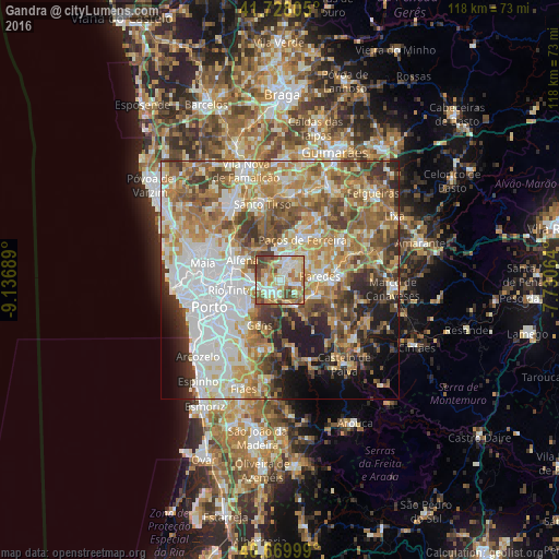
Analysis of Gandra night lights 2016
Square area 10x10 km:
 13.64%
90-99
21.27%80-89
12.82%70-79
14.12%60-69
16.23%50-59
8.12%40-49
12.66%30-39
1.14%20-29
0%10-19
0%0-9
0%Square area 50x50 km:
14.69%90-99
12.94%80-89
7.77%70-79
10.23%60-69
11.67%50-59
9.25%40-49
7.5%30-39
6.62%20-29
6.37%10-19
6.49%0-9
6.46%Clear (daylight) street map image can be seen on geolist.org.
Map coordinates:
41° 43' 41" North, 9° 8' 12.8" West
41° 12' 4.2" North, 8° 26' 1.5" West
40° 40' 12" North, 7° 43' 50.3" West
Some cities around Gandra sort by population:
• Valongo
5.6 km =3.5 mi,  255°
255°
• São Pedro da Cova
8.5 km =5.3 mi,  220°
220°
• Rebordosa
3.4 km =2.1 mi,  41°
41°
• Lordelo
4.5 km =2.8 mi,  34°
34°
• Madalena
8.5 km =5.3 mi,  78°
78°
• Campo
3.2 km =2 mi,  235°
235°
• Castelões de Cepeda
8.3 km =5.2 mi,  88°
88°
• Sobrado
2 km =1.2 mi,  300°
300°
2739080 (p: 6,034)
Sources (retrieved 2019-11-25):
» Earth at Night: Flat Maps 2012, 2016