Porto night lights from space
Night Light of Porto from space (Portugal) Src. Average luminocity for 10x10km area is 99.3799% and for 50x50km: 47.1064%.
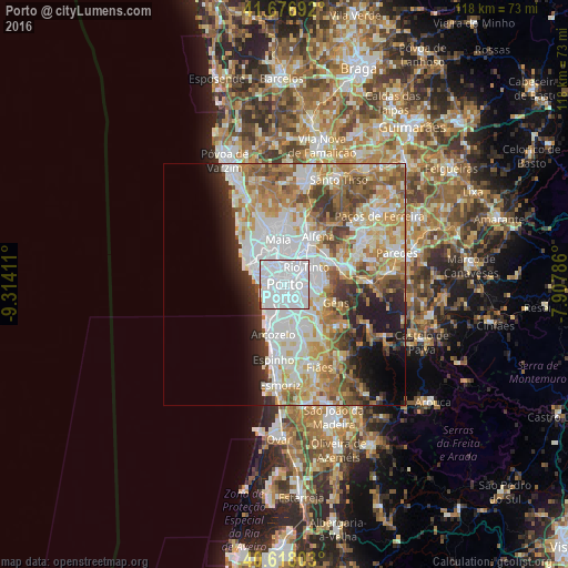
Analysis of Porto night lights 2016
Square area 10x10 km:
 87.34%
90-99
11.53%80-89
0%70-79
0.32%60-69
0.32%50-59
0%40-49
0.49%30-39
0%20-29
0%10-19
0%0-9
0%Square area 50x50 km:
14.13%90-99
10.65%80-89
5.23%70-79
6.88%60-69
7.5%50-59
5.01%40-49
4.28%30-39
3.94%20-29
4.91%10-19
6.11%0-9
31.37%Clear (daylight) street map image can be seen on geolist.org.
Map coordinates:
41° 40' 36.9" North, 9° 18' 50.8" West
41° 8' 58.6" North, 8° 36' 39.6" West
40° 37' 4.9" North, 7° 54' 28.3" West
Some cities around Porto sort by population:
• Vila Nova de Gaia
2.8 km =1.7 mi,  182°
182°
• Canidelo
4.2 km =2.6 mi,  225°
225°
• São Mamede de Infesta
4.7 km =2.9 mi,  359°
359°
• Oliveira do Douro
3.5 km =2.2 mi,  141°
141°
• Vilar de Andorinho
5.3 km =3.3 mi,  156°
156°
• Valbom
4.7 km =2.9 mi,  118°
118°
• Pedrouços
4.8 km =3 mi,  25°
25°
• Foz do Douro
5 km =3.1 mi,  271°
271°
2735943 (p: 249,633)
Sources (retrieved 2019-11-25):
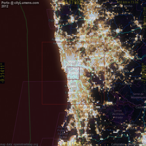
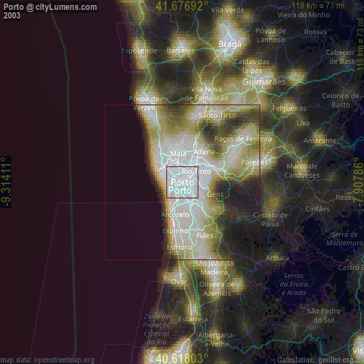
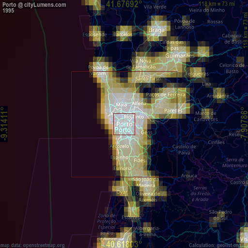
» NASA, Earths city lights 1995
» NASA city lights 2003
» Earth at Night: Flat Maps 2012, 2016