Oliveira do Douro night lights from space
Night Light of Oliveira do Douro (Porto) from space (Portugal) Src. Average luminocity for 10x10km area is 98.8734% and for 50x50km: 47.995%.
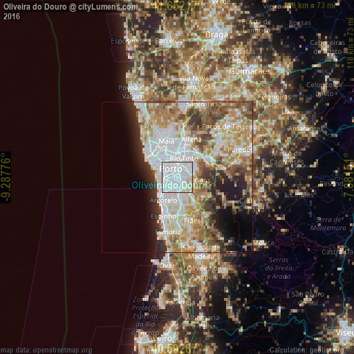

Analysis of Oliveira do Douro night lights 2016
Square area 10x10 km:
 81.17%
90-99
14.45%80-89
2.6%70-79
1.79%60-69
0%50-59
0%40-49
0%30-39
0%20-29
0%10-19
0%0-9
0%Square area 50x50 km:
13.99%90-99
10.56%80-89
5.23%70-79
7.43%60-69
7.62%50-59
5.25%40-49
4.65%30-39
4.27%20-29
5.29%10-19
6.59%0-9
29.12%Clear (daylight) street map image can be seen on geolist.org.
Map coordinates:
41° 39' 7.8" North, 9° 17' 15.9" West
41° 7' 28.8" North, 8° 35' 4.7" West
40° 35' 34.3" North, 7° 52' 53.4" West
Some cities around Oliveira do Douro sort by population:
• Porto
3.5 km =2.2 mi,  321°
321°
• Vila Nova de Gaia
2.3 km =1.4 mi,  268°
268°
• Gondomar
4.9 km =3 mi,  63°
63°
• Vilar de Andorinho
2.1 km =1.3 mi,  183°
183°
• Vilar do Paraíso
4.9 km =3 mi,  218°
218°
• Valbom
2 km =1.2 mi,  75°
75°
• Canelas
4.8 km =3 mi,  195°
195°
• Avintes
3.4 km =2.1 mi,  124°
124°
2737039 (p: 24,407)
Sources (retrieved 2019-11-25):
» Earth at Night: Flat Maps 2012, 2016