Alcains night lights from space
Night Light of Alcains (Guarda) from space (Portugal) Src. Average luminocity for 10x10km area is 11.9881% and for 50x50km: 4.6633%.
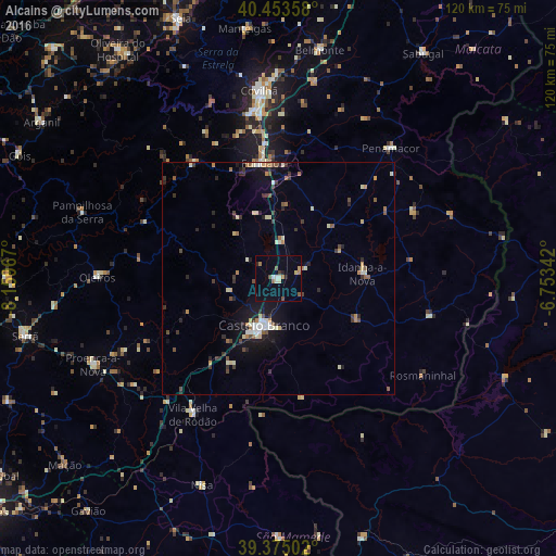
Analysis of Alcains night lights 2016
Square area 10x10 km:
 0.34%
0.34%90-99
2.72%80-89
1.02%70-79
0.68%60-69
2.55%50-59
1.87%40-49
1.02%30-39
0.68%20-29
1.53%10-19
0.51%0-9
87.07%Square area 50x50 km:
0.38%90-99
0.88%80-89
0.47%70-79
0.36%60-69
0.62%50-59
0.52%40-49
0.59%30-39
0.81%20-29
1.06%10-19
2.76%0-9
91.54%Clear (daylight) street map image can be seen on geolist.org.
Map coordinates:
40° 27' 12.9" North, 8° 9' 34.8" West
39° 54' 59.1" North, 7° 27' 23.6" West
39° 22' 30.1" North, 6° 45' 12.3" West
Some cities around Alcains sort by population:
• Castelo Branco
10.9 km =6.8 mi,  195°
195°
• Covilhã
40.8 km =25.4 mi,  354°
354°
• Fundão
25.2 km =15.7 mi, 351°
• Nisa
47.6 km =29.6 mi, 200°
• São Romão
58.2 km =36.2 mi,  337°
337°
• Valencia de Alcántara, ES
59 km =36.7 mi,  162°
162°
• Oleiros
39 km =24.2 mi,  270°
270°
• Sertã
56 km =34.8 mi,  256°
256°
2272197 (p: 5,030)
Sources (retrieved 2019-11-25):
» Earth at Night: Flat Maps 2012, 2016