Sertã night lights from space
Night Light of Sertã (Castelo Branco) from space (Portugal) Src. Average luminocity for 10x10km area is 15.4116% and for 50x50km: 5.7415%.
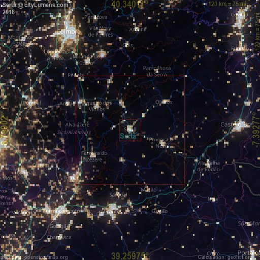
Analysis of Sertã night lights 2016
Square area 10x10 km:
 1.19%
1.19%90-99
2.21%80-89
3.4%70-79
0.34%60-69
1.7%50-59
2.55%40-49
1.19%30-39
4.42%20-29
1.7%10-19
3.57%0-9
77.72%Square area 50x50 km:
0.23%90-99
0.8%80-89
0.51%70-79
0.64%60-69
0.87%50-59
1.03%40-49
0.72%30-39
0.99%20-29
1.94%10-19
1.74%0-9
90.53%Clear (daylight) street map image can be seen on geolist.org.
Map coordinates:
40° 20' 24.4" North, 8° 47' 56.5" West
39° 48' 7.4" North, 8° 5' 45.2" West
39° 15' 35.1" North, 7° 23' 34" West
Some cities around Sertã sort by population:
• Tomar
34.8 km =21.6 mi,  230°
230°
• Pombal
47.2 km =29.3 mi,  285°
285°
• Abrantes
38.3 km =23.8 mi,  193°
193°
• Ourém
46 km =28.6 mi,  247°
247°
• Lousã
37.3 km =23.2 mi,  339°
339°
• Miranda do Corvo
38.1 km =23.7 mi,  328°
328°
• Oleiros
20.3 km =12.6 mi,  50°
50°
• Poiares
47.4 km =29.5 mi, 343°
2262987 (p: 5,636)
Sources (retrieved 2019-11-25):
» Earth at Night: Flat Maps 2012, 2016