Oranit night lights from space
Night Light of Oranit (West Bank) from space (Palestinian Territory) Src. Average luminocity for 10x10km area is 86.3531% and for 50x50km: 68.7054%.
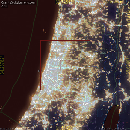
Analysis of Oranit night lights 2016
Square area 10x10 km:
 24.83%
90-99
27.8%80-89
18.53%70-79
12.41%60-69
7.17%50-59
9.27%40-49
0%30-39
0%20-29
0%10-19
0%0-9
0%Square area 50x50 km:
18.82%90-99
16.89%80-89
12.77%70-79
8.7%60-69
5.85%50-59
7.52%40-49
8.67%30-39
7.15%20-29
6.63%10-19
2.41%0-9
4.6%Clear (daylight) street map image can be seen on geolist.org.
Map coordinates:
32° 43' 30.5" North, 34° 17' 16.2" East
32° 7' 53.9" North, 34° 59' 27.4" East
31° 32' 3.4" North, 35° 41' 38.7" East
Some cities around Oranit sort by population:
• Kfar Saba, IL
9.3 km =5.8 mi,  301°
301°
• Qalqīlyah
6.7 km =4.2 mi,  343°
343°
• Rosh Ha‘Ayin, IL
5.2 km =3.2 mi,  218°
218°
• Kafr Qāsim, IL
2.4 km =1.5 mi, 215°
• Bidyā
8.6 km =5.3 mi,  102°
102°
• ‘Azzūn
7.9 km =4.9 mi,  52°
52°
• Jaljūlya, IL
4.3 km =2.7 mi,  306°
306°
• Ḩablah
3.9 km =2.4 mi, 341°
8199420 (p: 6,205)
Sources (retrieved 2019-11-25):
» Earth at Night: Flat Maps 2012, 2016