Pájaros night lights from space
Night Light of Pájaros (Toa Alta) from space (Puerto Rico) Src. Average luminocity for 10x10km area is 83.5248% and for 50x50km: 41.5769%.
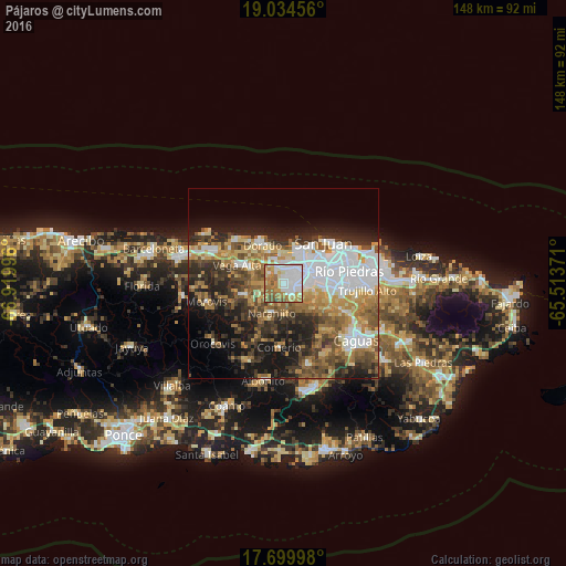
Analysis of Pájaros night lights 2016
Square area 10x10 km:
 29.55%
90-99
21.9%80-89
8.88%70-79
9.92%60-69
21.69%50-59
4.75%40-49
2.89%30-39
0.41%20-29
0%10-19
0%0-9
0%Square area 50x50 km:
10.3%90-99
5.92%80-89
4.92%70-79
5.55%60-69
7.63%50-59
5.6%40-49
6.07%30-39
6.61%20-29
8.81%10-19
11.89%0-9
26.7%Clear (daylight) street map image can be seen on geolist.org.
Map coordinates:
19° 2' 4.4" North, 66° 55' 11.9" West
18° 22' 6.8" North, 66° 13' 0.6" West
17° 41' 59.9" North, 65° 30' 49.4" West
Some cities around Pájaros sort by population:
• Bayamón
7.3 km =4.5 mi,  62°
62°
• Candelaria
4 km =2.5 mi,  12°
12°
• Campanilla
6.2 km =3.9 mi,  340°
340°
• Sabana Seca
7.3 km =4.5 mi,  27°
27°
• Candelaria Arenas
5.4 km =3.4 mi,  359°
359°
• Ingenio
8.2 km =5.1 mi,  353°
353°
• Toa Alta
4 km =2.5 mi,  303°
303°
• Naranjito
8.1 km =5 mi,  201°
201°
4566470 (p: 9,466)
Sources (retrieved 2019-11-25):
» Earth at Night: Flat Maps 2012, 2016