Bayamón night lights from space
Night Light of Bayamón from space (Puerto Rico) Src. Average luminocity for 10x10km area is 98.8037% and for 50x50km: 42.5423%.
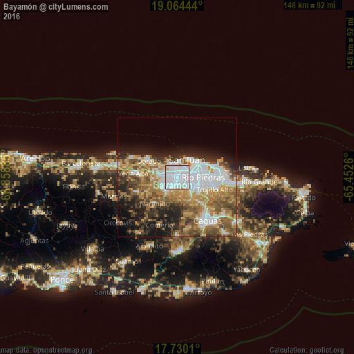
Analysis of Bayamón night lights 2016
Square area 10x10 km:
 78.31%
90-99
17.77%80-89
3.1%70-79
0.83%60-69
0%50-59
0%40-49
0%30-39
0%20-29
0%10-19
0%0-9
0%Square area 50x50 km:
10.86%90-99
6.56%80-89
4.9%70-79
5.9%60-69
8.24%50-59
6.06%40-49
6.46%30-39
5.6%20-29
7.01%10-19
9.36%0-9
29.05%Clear (daylight) street map image can be seen on geolist.org.
Map coordinates:
19° 3' 52" North, 66° 51' 31.9" West
18° 23' 54.8" North, 66° 9' 20.6" West
17° 43' 48.4" North, 65° 27' 9.4" West
Some cities around Bayamón sort by population:
• Guaynabo
6.6 km =4.1 mi,  134°
134°
• Levittown
6.3 km =3.9 mi,  334°
334°
• Cataño
6.2 km =3.9 mi,  39°
39°
• Candelaria
5.6 km =3.5 mi,  276°
276°
• Pájaros
7.3 km =4.5 mi,  242°
242°
• Campanilla
8.9 km =5.5 mi,  286°
286°
• Sabana Seca
4.4 km =2.7 mi,  315°
315°
• Candelaria Arenas
6.8 km =4.2 mi, 287°
4562831 (p: 203,499)
Sources (retrieved 2019-11-25):
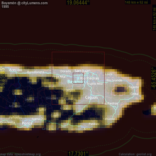
» NASA, Earths city lights 1995
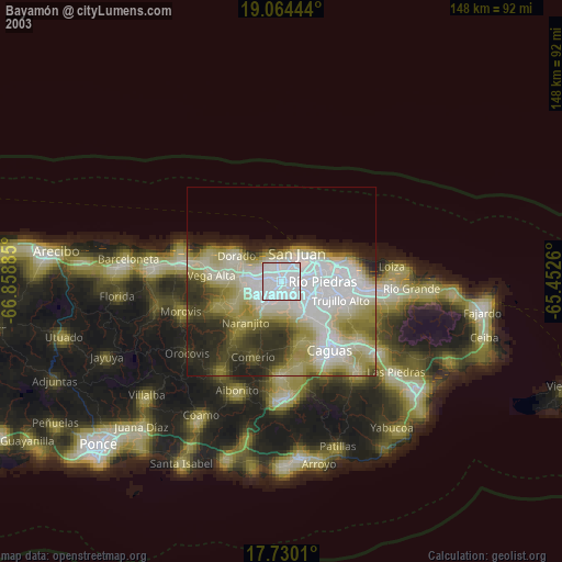
» NASA city lights 2003
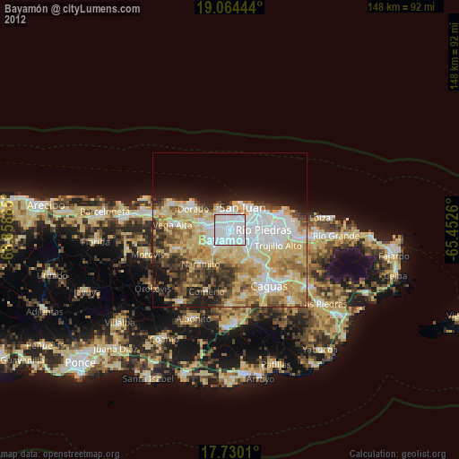
» Earth at Night: Flat Maps 2012, 2016