Toa Alta night lights from space
Night Light of Toa Alta from space (Puerto Rico) Src. Average luminocity for 10x10km area is 78.1674% and for 50x50km: 38.5335%.
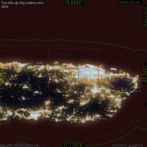
Analysis of Toa Alta night lights 2016
Square area 10x10 km:
 13.43%
90-99
19.42%80-89
13.84%70-79
14.46%60-69
25.41%50-59
11.78%40-49
1.65%30-39
0%20-29
0%10-19
0%0-9
0%Square area 50x50 km:
9.51%90-99
5.49%80-89
4.77%70-79
5.19%60-69
7.06%50-59
4.62%40-49
5.38%30-39
6.4%20-29
8.59%10-19
11.05%0-9
31.94%Clear (daylight) street map image can be seen on geolist.org.
Map coordinates:
19° 3' 15.1" North, 66° 57' 4.9" West
18° 23' 17.8" North, 66° 14' 53.6" West
17° 43' 11.2" North, 65° 32' 42.4" West
Some cities around Toa Alta sort by population:
• Candelaria
4.5 km =2.8 mi,  67°
67°
• Dorado
8.1 km =5 mi,  345°
345°
• Pájaros
4 km =2.5 mi,  123°
123°
• Campanilla
3.9 km =2.4 mi,  18°
18°
• Sabana Seca
8 km =5 mi,  57°
57°
• Candelaria Arenas
4.6 km =2.9 mi,  45°
45°
• Ingenio
6.4 km =4 mi, 21°
• Toa Baja
6.3 km =3.9 mi, 348°
4568403 (p: 4,483)
Sources (retrieved 2019-11-25):
» Earth at Night: Flat Maps 2012, 2016