Arecibo night lights from space
Night Light of Arecibo from space (Puerto Rico) Src. Average luminocity for 10x10km area is 45.6488% and for 50x50km: 15.8811%.
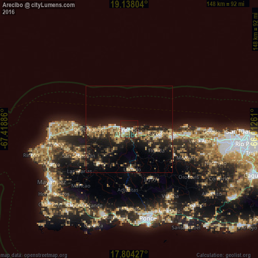
Analysis of Arecibo night lights 2016
Square area 10x10 km:
 7.23%
7.23%90-99
9.5%80-89
5.58%70-79
6.4%60-69
7.02%50-59
4.13%40-49
5.58%30-39
4.13%20-29
23.76%10-19
20.66%0-9
5.99%Square area 50x50 km:
0.93%90-99
1.08%80-89
2.6%70-79
2.42%60-69
3.37%50-59
1.83%40-49
2.23%30-39
3.42%20-29
7.14%10-19
13.64%0-9
61.34%Clear (daylight) street map image can be seen on geolist.org.
Map coordinates:
19° 8' 16.9" North, 67° 25' 7.9" West
18° 28' 20.8" North, 66° 42' 56.6" West
17° 48' 15.4" North, 66° 0' 45.4" West
Some cities around Arecibo sort by population:
• Barceloneta
18.8 km =11.7 mi,  97°
97°
• Manatí
24.1 km =15 mi, 101°
• Utuado
23.1 km =14.4 mi,  175°
175°
• Estancias de Florida
19.4 km =12.1 mi,  127°
127°
• Florida
20.4 km =12.7 mi, 126°
• Hatillo
11.7 km =7.3 mi,  277°
277°
• Quebradillas
23.5 km =14.6 mi,  270°
270°
• Camuy
13.7 km =8.5 mi, 275°
4562635 (p: 49,318)
Sources (retrieved 2019-11-25):
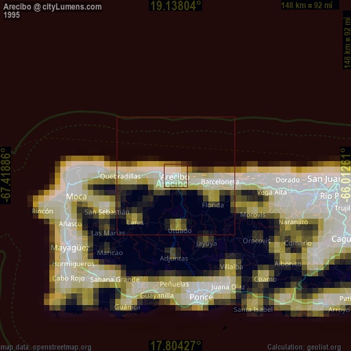
» NASA, Earths city lights 1995
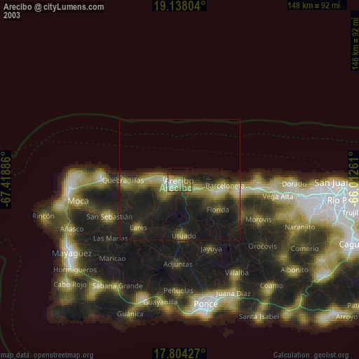
» NASA city lights 2003
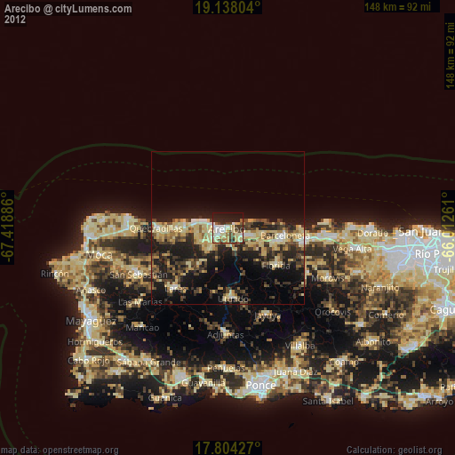
» Earth at Night: Flat Maps 2012, 2016