Manatí night lights from space
Night Light of Manatí from space (Puerto Rico) Src. Average luminocity for 10x10km area is 51.0826% and for 50x50km: 20.5175%.
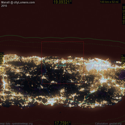
Analysis of Manatí night lights 2016
Square area 10x10 km:
 5.99%
5.99%90-99
7.23%80-89
11.36%70-79
5.58%60-69
9.92%50-59
1.24%40-49
10.54%30-39
12.4%20-29
29.75%10-19
5.99%0-9
0%Square area 50x50 km:
1.32%90-99
1.67%80-89
3.4%70-79
3.16%60-69
4.3%50-59
2.58%40-49
3.88%30-39
5.51%20-29
8.59%10-19
11.05%0-9
54.53%Clear (daylight) street map image can be seen on geolist.org.
Map coordinates:
19° 5' 35.6" North, 67° 11' 42.9" West
18° 25' 38.8" North, 66° 29' 31.6" West
17° 45' 32.8" North, 65° 47' 20.4" West
Some cities around Manatí sort by population:
• Vega Baja
11.2 km =7 mi,  80°
80°
• Barceloneta
5.5 km =3.4 mi,  297°
297°
• Vega Alta
17.1 km =10.6 mi,  95°
95°
• Ceiba
15.1 km =9.4 mi, 81°
• Estancias de Florida
10.6 km =6.6 mi,  230°
230°
• Florida
10.3 km =6.4 mi, 225°
• Ciales
10.5 km =6.5 mi,  166°
166°
• Morovis
14.5 km =9 mi,  141°
141°
4566137 (p: 16,092)
Sources (retrieved 2019-11-25):
» Earth at Night: Flat Maps 2012, 2016