Żychlin night lights from space
Night Light of Żychlin (Łódź Voivodeship) from space (Poland) Src. Average luminocity for 10x10km area is 2.6984% and for 50x50km: 3.0258%.
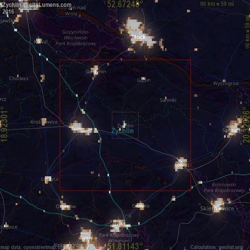
Analysis of Żychlin night lights 2016
Square area 10x10 km:
 0.26%
0.26%90-99
0.79%80-89
0%70-79
0.53%60-69
0%50-59
1.06%40-49
0.53%30-39
0%20-29
0%10-19
0.53%0-9
96.3%Square area 50x50 km:
0.53%90-99
0.59%80-89
0.29%70-79
0.22%60-69
0.32%50-59
0.37%40-49
0.3%30-39
0.1%20-29
0.18%10-19
2.81%0-9
94.27%Clear (daylight) street map image can be seen on geolist.org.
Map coordinates:
52° 40' 20.9" North, 18° 55' 22.8" East
52° 14' 38.5" North, 19° 37' 34.1" East
51° 48' 41.1" North, 20° 19' 45.3" East
Some cities around Żychlin sort by population:
• Płock
34.1 km =21.2 mi,  9°
9°
• Kutno
17.9 km =11.1 mi,  265°
265°
• Sochaczew
41.7 km =25.9 mi,  92°
92°
• Łowicz
26.6 km =16.5 mi,  124°
124°
• Ozorków
38.7 km =24 mi,  216°
216°
• Gostynin
23.4 km =14.5 mi,  331°
331°
• Łęczyca
35.6 km =22.1 mi,  234°
234°
• Głowno
31.7 km =19.7 mi,  168°
168°
3079897 (p: 9,009)
Sources (retrieved 2019-11-25):
» Earth at Night: Flat Maps 2012, 2016